Friday, December 16, 2016

Maddron Bald and Albright Grove Loop Trails

New Miles Completed: 8.0
Total Miles Hiked: 15.0
15 December 2016

Maddron Bald trail starts along the northern border of the GSMNP, just south of US Route 321 in between Gatlinburg and Cosby.  The trailhead is a little sketchy and apparently break-ins and vandalism of cars is not uncommon here.  I took a chance, since I was just going to be here for the day, and went ahead and parked at the trailhead - no problems.


At the trailhead.
Let me say right off the bat that the Maddron Bald trail gains about 3500' of elevation over its length of 7.3 miles, and is pretty much continually up, with few level spots.  It's pretty gradual for most of the trail though, and rarely brutally steep.  The bottom section, from the trailhead to Albright Grove is relatively easy hiking along a well-graded trail.  The trail starts off as a gravel road, and passes through parts of the park that were clearly inhabited pre-park.  You can see several rock walls off to either side of the trail (especially easy in the winter when the leaves are gone), and you pass by the well-maintained Willis Baxter one-room log cabin about 0.7 miles up the trail.

Willis Baxter cabin, ca. 1889
A little further on you reach a 4-way trail junction:  Maddron Bald trail runs south-north, Gabes Mountain trail leads east toward Cosby, and the Old Settlers Trail leads west toward Greenbriar.

Old Settler trail

Gabes Mountain trail
From here the Maddron Bald trail continues to lead south and up.  It's still gravel for a while, but narrower and rockier.  The trail leads through typical Smokies Hemlock forest with lots of Rhododenron, Eastern Hemlock, and Tulip Trees.  Ultimately the gravel road peters out, and you find yourself on a narrow trailbed with lots of rocks and roots, still continually climbing.  At nearly 3 miles from the trailhead you cross Indian Camp Creek on the only bridged water crossing of the trail.

Footlog bridge over Indian Camp Creek
Shortly after crossing the bridge you reach the southern junction of the Maddron Bald and Albright Grove Loop trails.  Albright Grove is a 0.7 mile loop that juts off of the Maddron Bald trail and runs up and down the ridge above the Maddron Bald trail through an impressive stand of old growth forest.  I chose to head on up the Maddron Bald trail now, and did the Albright Grove Loop on my way back down.

Northern junction of Maddron Bald & Albright Grove Loop trails

Southern junction of Maddron Bald & Albright Grove Loop trails
It has only been a few weeks since the devastating forest fire swept through the Smokies and then down into Gatlinburg.  This area of the park was not burned, but the strong winds from the storm that swept the fire into an inferno clearly affected this area as well.  There were LOTS of downed trees across and near the trail.  Trail maintenance crews are going to have their work cut out for them this year.

Downed tree blocking the trail.
From Albright Grove it's another 4 miles to the top end of the Maddron Bald trail.  The trail climbs the side of one ridge, then continuously rises in and out along of a couple more ridges until it reaches Backcountry Campsite #29 at Otter Creek, about 2.5 miles above Albright Grove.  This campsite sits on a narrow shelf right along Otter Creek.  It has 2 fire rings and 2 sets of bear cables, but not very many flat spots for tents.  

Backcountry Campsite #29

Backcountry Campsite #29.  Looking up from the bottom toward the trail.
From campsite #29 the Maddron Bald trail turns north and climbs the flank of Maddron Bald itself.  It's about 1.5 miles from #29 to the trail terminus.  The first part of this section is a ridge-side climb that affords some nice views back down into the valley that you have just climbed up through.  The high-elevation trees were coated with rime ice that made a beautiful contrast with the evergreens.

Trees covered in rime ice at high elevation
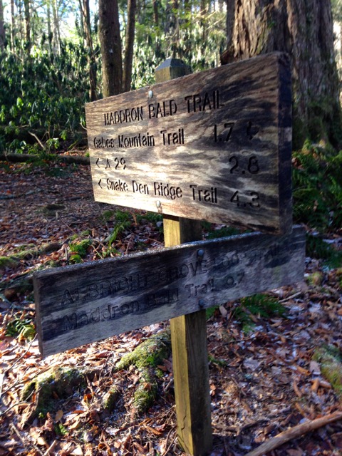
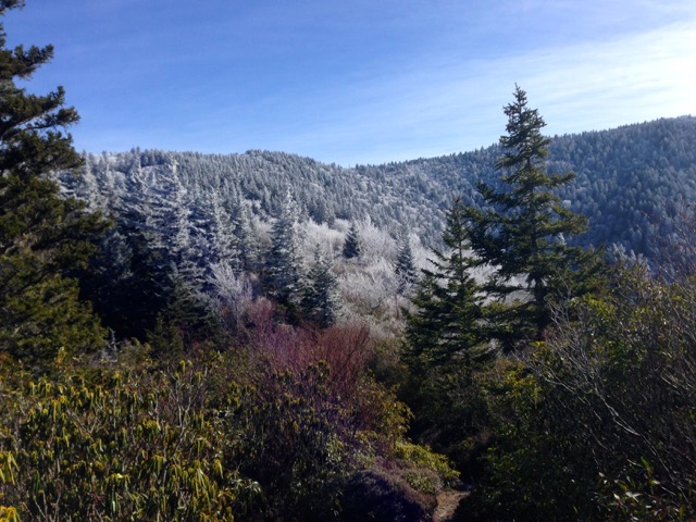
The trail then reaches the summit ridge of Maddron Bald and traverses that ridge on its way over to the junction with the Snake Den Ridge trail.  Maddron Bald is a heath bald, much like Brushy Mountain.  The top of the ridge has few tall trees, but is covered with Rhododendron, Mountain Laurel and Sand Myrtle, and the trail is deeply rutted into the earth.  This section of the trail is reasonably level, and then even drops off just a bit as it comes off of Maddron Bald and heads over to the end of the trail.  There are several spots with lovely views along the top of Maddron Bald.  The trail ends at its junction with Snake Den Ridge trail, just 0.7 miles below the Appalachian Trail.  I stopped here, glad to be done with the climbing for the day and ate some lunch.  But I didn't stay long - it was too cold!  My little thermometer said 15 degrees.  I stayed just about 15 minutes to eat, drink and rest, and then turned and headed back down.

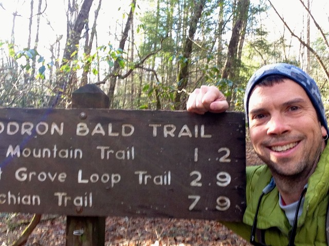
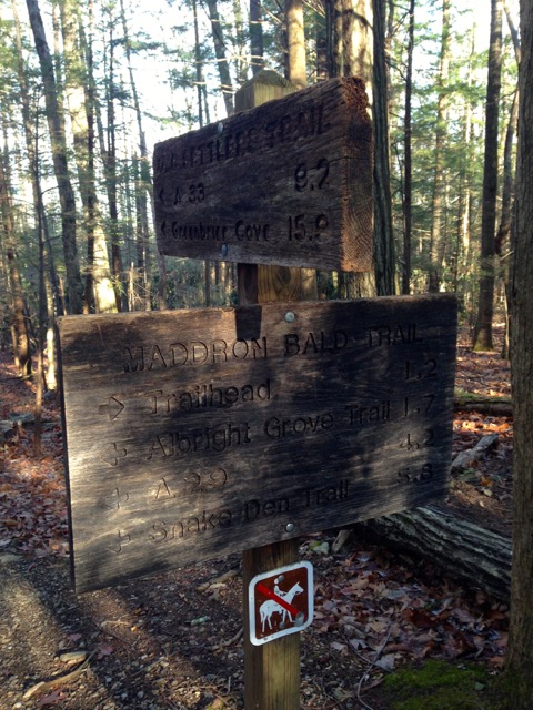
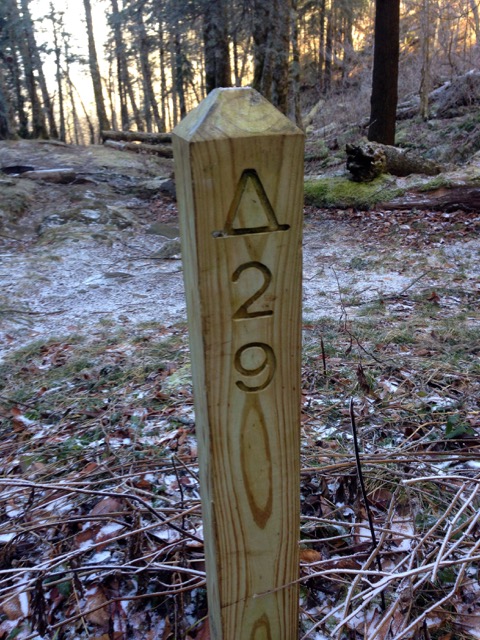
Maddron Bald - Snake Den Ridge trail junction

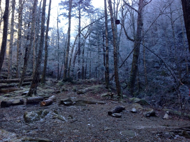
Brrr!  15 degrees at the top
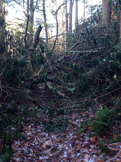
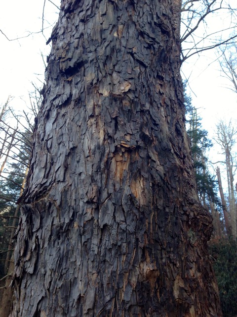
I retraced my steps back down Maddron Bald trail, taking time to do the Albright Grove Loop trail as well.  The 0.7 mile Albright Grove Loop meanders along a ridge side, and then meets up with Dunn Creek before junctioning back to Maddron Bald trail.  Because this area was not logged some of the trees are absolute giants.  Tulip Trees, Hemlocks and Silver Bells are among some of the biggest trees.  Sadly, the storms had knocked down a lot of trees along here as well, and the trail was littered with the debris of broken trees and branches.

The distinctive bark of a huge Silver Bell tree
I made it back to my car safe and sound, happy, but tired and cold.  It was a tough hike - the elevation gain was really strenuous.  But the views were amazing and the solitude rewarding.  I only saw one other person on the trail, and that was when I was nearly back to my car.  Winter hiking in the Smokies is really rewarding if you are ready to brave the cold, and prepared.  

Til next time, happy hiking!