New Miles: 5.4
Total Miles: 14.3
9-10 October, 2023
Finally... I've been thinking about this trip, and planning for this trip for a LONG time, wondering if it would ever get here. But it finally did. I wanted to save the Boulevard trail for my last hike to complete the trails of the Smokies. I love high elevation trails, I love Mt. LeConte, and it felt like the best way to wrap up this grand adventure. Plus, autumn in the Smokies...
 |
| Day 1: blue, Day 2: green, overnight at Icewater Spring Shelter |
Parking and traffic in the Smokies in October is always a little nuts. Lots of tourists flocking to the park to see the fall leaves and hike in the woods. With the recent crackdown on parking, it's getting more and more difficult to find a parking spot at the popular trailheads. SO I decided to try the shuttle services offered by Smoky Rides (part of Smoky Mountain Guides). I parked in Gatlinburg ($15) and got a ride up to Newfound Gap ($20), and then got picked up the next day at Alum Cave Bluff trailhead ($20). They were super friendly and helpful. The only difficult part was that I got back to the trailhead early and had no way to contact them to let them know since there's no cell service in most of the park. So I sat and waited for about an hour. Not their fault, just an unfortunate side effect.
 |
| Trailhead selfie at Newfound Gap |
Day 1: Newfound Gap to Icewater Spring shelter (2.9 mi) and a side hike to the Jumpoff
I've hiked this section of the Appalachian Trail a bunch of times. This is a popular section with lots of dayhikers heading out to Charlies Bunion. I love the vibe of the AT through the park - literally walking on the ridge at the top of the primary mountain chain of the Smokies. Nice views to either side, and the spruce-fir forest all around.
 |
| The Appalachian Trail northeast of Newfound Gap |
The trail winds up and down a bit on its way north and east, passing by the Sweat Heifer trail junction to the right (south), and the the Boulevard trail junction to the left (north) before reaching the Icewater Spring shelter at about mile 2.9, and which was my destination for the night.
I got to the shelter around 3 pm, and there were already a few folks there for the night. I set up my sleeping gear in one corner, said hello to the other folks who were there, and then took off back down the trail for the short hike out to the Jumpoff.
The trail to the Jumpoff is not one of the official maintained trails in the park, but there is a trail sign nonetheless. Just a little ways up the Boulevard trail the side trail to the Jumpoff turns east and heads out to the edge of the ridge. It climbs steeply for a bit, then levels out, then drops steeply for a bit. The trail ends at a small clearing situated on the immediate edge of a very tall and steep dropoff. The views to the east are absolutely amazing - well worth the short hike.
I stopped here, had a snack and read for a while (oh - and I actually had enough cell service to send Sarah a picture!). It was a really nice relaxing way to spend an hour or so.
 |
| Side trail to the Jumpoff |
 |
| View from the Jumpoff |
About 4:30 pm I packed back up and hiked back to Icewater Shelter. Cooked dinner (Mtn House Chicken Pad Thai - very yummy), had a cup of hot chocolate, and gathered up some wood for a fire in the shelter fireplace. It was a chilly night - predicted temps in the 20s. I was prepared with my 0-degree sleeping bag and stayed very warm. Wood was in short supply in the area, but a few of us managed to gather enough for a good fire. Most folks were in bed by 7:30 when it got dark. I finally climbed in my bag about 8:30 and listened to the cacophony of snoring (to which I too surely contributed when I finally fell asleep...).
Day 2: Boulevard trail to Mt. LeConte, then down Alum Cave Bluff trail to the road.
Folks started stirring around 6 am. Knowing I had all day to go just about 11 miles I lazed in bed til about 7 am (plus it was cold out there!). When I finally crawled out of my bag and made it out of the shelter I was greeted by a beautiful crescent moon and the planet Venus shining down on me. The sky was clear and they were brilliant!
 |
| Tuesday morning early - the moon & Venus in view |
Not too long til the sun started to come up with a tinge of orange painting the sky followed by the burning orange ball of the rising sun. It was one of the most beautiful sunrises I remember! I had always heard that Icewater Spring shelter was a good sunrise spot, and now I know that's true!
 |
| Tuesday morning sunrise from Icewater Spring shelter |
 |
| Icewater Spring shelter |
Got packed up and ready to hit the trail. 0.2 miles back down the AT to the Boulevard trail. There was a lot of emotion, excitement, reminiscing, gratitude, and amazement running around in my head as I started this last trail. I was excited for the day - this is one of my favorite kinds of high elevation trails, and the weather and views were fantastic. I was thinking of all of the different people who had hiked with me in the Smokies over the years... family, friends, scouts and scouters, botanical colleagues and wildflower pilgrims. Such wonderful community and support I've had in this long quest.
 |
| Here we go! Junction of the Boulevard trail with the AT |
 |
| Boulevard trail - heading north from the AT |
 |
| Fabulous views from the Boulevard trail |
Boulevard trail drops about 500' in elevation over the first mile. The walking is easy, the trail can be rocky & rooty but is generally in good shape. You are walking through Northern Hardwood Forest with lots of maples, beech, and birch, and Spruce-Fir forest, so you get the nice contrast of the dark green of the evergreens and the yellows of the hardwoods. Fall is definitely going on here at 5000-6000' elevation!
After the first mile the trail begins to climb, gently at first, and then more steeply the closer you get to Mt. LeConte. You get glimpses of LeConte from the trail, and it's pretty imposing, towering over the top of you as you approach.
 |
| Switchback at Anakeesta Knob |
 |
| The bright red fruits of the Rowan tree really stand out |
The last mile or so as you are coming up the south side of LeConte gets REALLY steep, but there are some impressive views. There are rock-slide scars with cables attached to the rocks to give you something to hold on to as you traverse steep & unprotected areas. Lots of scrambling over rock outcrops. Kind of an intimidating, but exhilarating section of trail!
 |
| Boulevard trail - approaching Mt. LeConte |
 |
| Landslide scar on the Boulevard trail on south side of Mt. LeConte |
Maybe half a mile below the summit of Mt. LeConte you reach the side trail to Myrtle Point. This is supposed to be an excellent spot to watch the sunrise and folks often trek from the Lodge or LeConte shelter out to Myrtle Point in the early morning.
The views were fantastic even at 11 o'clock in the morning! There is ridge, upon ridge, upon ridge of mountains flowing away from you. Just utterly beautiful.
 |
| Side trail to Myrtle Point |
 |
| View from Myrtle Point |
 |
View from Myrtle Point
|
 |
View from Myrtle Point
|
I spent maybe 20 minutes at Myrtle Point getting a snack and a drink, taking pictures, and soaking it all in. It was very windy, so as I started to get chilled I decided it was time to move on. At this point I was only about 1/2 mile from finishing the Boulevard trail, and my quest!
Hiked the rest of the way up to the Mt. LeConte summit, called High Top, with its funny pile of rocks (and yes, I brought one up to add to the top of the pile). Then passed the LeConte shelter, which is currently closed because of aggressive bears.
 |
| High Top - the Mt. LeConte summit |
 |
| LeConte shelter |
And then, there it was. The trail sign for the junction of the Boulevard trail and the Rainbow Falls trail. The end of my very last trail.
 |
| Done! End of Boulevard trail at its junction with Rainbow Falls trail |
Of course, I had to do all of the Mt. LeConte things. I stopped and got my picture at the Dining Hall. Then went out to Cliff Tops - one of my favorite spots, but WOW was it windy that day!  |
| Required picture with the LeConte Lodge sign |
 |
| Views from Cliff Tops |
And then I headed down Alum Cave Bluff trail to wrap up my trip. This will always be one of my favorite trails in the park - so many great things to see: the bluff, inspiration point, arch rock, Styx creek... So much good stuff packed into 5 miles!
 |
| Alum Cave Bluff |
 |
| view from Inspiration Point |
 |
| Arch Rock as seen from above |
 |
Arch Rock as seen from below
|
I had a little extra time before the shuttle was going to pick me up, so I pulled off on the side of the trail and spent some time just listening to the sound of Styx Creek. There is *nothing* like the sound of a mountain creek. So joyful, so relaxing, so peaceful.
 |
| Styx Creek |
 |
| Alum Cave Creek |
 |
| End of trail selfie |
Finally made it out to the end of Alum Cave trail and sat down to wait on my ride. I couldn't help but think back on all of the hikes, all of the hiking companions, all of the amazing views and wildlife and inspirational moments. This has truly been a quest of a lifetime. I'm so glad I decided to do this. And I look forward to all of the hikes to come, inside the Smokies, and out.
Wherever life takes you, always remember the John Muir quote: "Of all the paths you take in life, make sure a few of them are dirt." Or as Edward Abbey said "May your trails be crooked, winding, lonesome, dangerous, leading to the most amazing view. May your mountains rise into and above the clouds."
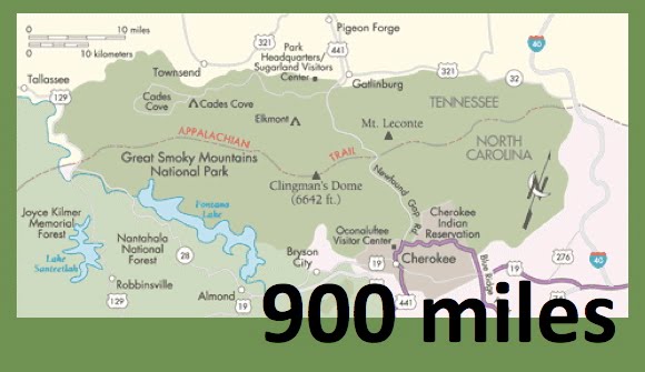
 |
| My virtual $1 trail map, with all of the trails marked off! |
Til next time, happy hiking!