New Miles Completed: 7.5
Total Miles Hiked: 15.0
7 Aug. 2019
Did a day hike to knock out the Kanati Fork and a chunk of the Thomas Divide trails. Definitely not the most efficient way to do these trails as I hiked every each of each trail twice... But I got them done! And it was a beautiful day - lovely weather with a nice breeze. It was pretty humid, but not terribly hot.
I hiked up the Kanati Fork trail to Thomas Divide (2.9 miles), hiked north on the Thomas Divide trail to Newfound Gap Road (1.8 miles), turned around and hiked south on Thomas Divide to the junction with Sunkota Ridge trail (2.8 miles), turned back north and hiked to Kanati Fork trail, then down Kanati Fork back to my car.
 |
| Kanati Fork and Thomas Divide trail sections completed in orange |
Most of the sections I need to complete in NC will be backpacking trips, but there are still a few that are doable as day hikes, and this was one. Summer is slipping away, and school starts in a couple of weeks so I wanted to get in one more trip.
 |
| Kanati Fork trailhead selfie |
 |
| Beginning of the Kanati Fork trail |
Here's the Kanati Fork trail in a nutshell: steep as heck with 5 gazillion switchbacks.
There really not a whole lot to recommend about this trail. The elevation profile in the little brown book shows a constantly ascending straight line going from 2900' up to 5000' - a 2100' elevation gain over 2.9 miles. While the trail is named for the creek that it parallels, there are really no views of the creek as the trail is on the ridge high above the creek. The trail climbs consistently up toward Thomas Divide climbing up the sides of the ridge, crossing small creeks that feed into Kanati Fork, and then a switchback to continue the ascent.
This is a good trail for wildflowers, especially in the wet areas where the trail crosses the feeder creeks. There are some nice stands of crimson beebalm and cone flower, and big clumps of brook lettuce growing in the creeks. There is also LOTS of stinging nettle in the wet sections.
 |
| Crimson Beebalm & Coneflower |
 |
| Brook lettuce |
For the most part the Kanati Fork trail is in good shape. It's mostly reasonably wide and not terrible rooty or rocky. The sections where it crosses the creeks are rocky, of course, and there are a few stretches (especially in the upper part of the trail) where it's narrow and eroded, but overall it's in good shape.
Kanati Fork trail ends when it junctions with the Thomas Divide trail. It's a nice flat spot for a trail junction with some tree trunks for sitting on. I stopped for a quick snack before turning north on the Thomas Divide trail.
 |
| Kanati Fork - Thomas Divide trail junction |
 |
| Chestnut trees on Thomas Divide trail: an old downed trunk, and a new stump sprout |
 |
| Thomas Divide Trail |
The section of Thomas Divide that I did doesn't have a huge amount of elevation change. From the Kanati Fork junction north, the first mile is absolutely lovely, flat and grass and fern-lined. It made me think of the John Muir quote about "sauntering" through the mountains - it was a lovely stroll!
Toward the northern end (as you approach Newfound Gap Road) the trail does drop in elevation, which means it climbs from Newfound Gap Road if you are headed that direction, but only for about 3/4 of a mile. This section of trail had LOTS of chestnut trees, ranging from small saplings to trees that are up to 6" in diameter and maybe 15' tall. I love seeing the chestnut trees, even though I know these trees will also eventually succumb to the blight. I love to imagine what the forests looked like when the chestnuts were dominant.
 |
| Thomas Divide trailhead at Newfound Gap Road |
 |
| Gigantic boulder smack dab in the middle of the trail near the Thomas Divide trailhead |
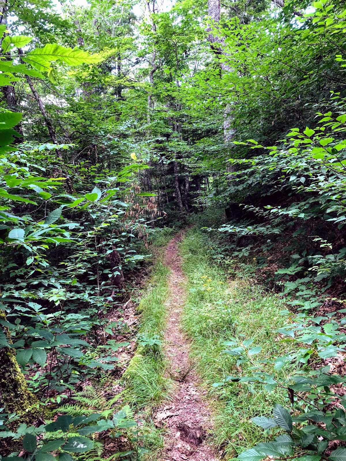
From here I turned around and retraced my steps back south toward Kanati Fork. Stopped for a quick lunch at the Kanati Fork - Thomas Divide trail junction, and then headed south on Thomas Divide toward Sunkota Ridge trail. In this section the trail rises about 200' in elevation over the first half mile, then drops about 600' over the next mile as it heads towards Tuskee Gap, and then climbs back up another 300' or so as it nears Sunkota Ridge trail. So it's kind of a roller coaster, up then down then up, but it's never terribly steep. In some spots the trail is wide and fern-lined, in others it's narrow and vegetation is encroaching over the trail. But overall it's a very pleasant walk in the woods.
 |
| Ridge-side walk on the Thomas Divide trail |
Saw some more nice wildflowers on this chunk of the trail including Yellow Fringed Orchid, Indian Pipe, Black-eyed Susan, LOTS of Goldenrod that was a favorite with the bees and butterflies, and even a couple of Columbines (they were flowering at low elevation back in April!)
 |
| Yellow Fringed Orchid |
 |
| Swallowtail butterfly & Goldenrod |
 |
| Black-eyed Susan |
 |
| A VERY late-blooming Columbine |
 |
| Indian Pipe |
When I reached the Thomas Divide - Sunkota Ridge trail junction I stopped for a snack and water break and got out my map to peruse the trails in this area. The section from here south is all new to me - still blank spots on my map. So I was mentally planning how to best get those done while I rested for a bit.
 |
| Thomas Divide - Sunkota Ridge trail junction |
From here I turned around and retraced my steps back up to the Kanati Fork trail junction, and then back down Kanati Fork to my car. It was a truly lovely day. Not the ideal way to check off miles, doing everything twice, but it got the job done. Late summer at high elevation on the Smokies is really nice.
Til next time, happy hiking!


No comments:
Post a Comment