
New miles hiked: 32.7
Total Miles hiked: 39.1
16-18 October 2020
Autumn is, without a doubt, the finest hiking season. Warm sunny days, cool nights, beautiful views...
This trip took me in to the park at Fontana Dam and up the Lakeshore Trail. Eagle Creek goes UP from there to the crest of the Smokies and the AT at Spence Field. Jenkins Ridge then drops off the AT and goes DOWN the ridge toward Hazel Creek which ultimately put me back at the Lakeshore Trail, and back to Fontana.
 |
| Red: day 1, Green: day 2, Blue: day 3 |

Day 1: Fontana to CS#97. 10 miles (11 actually...)
I hit the trail early afternoon. I had about 10 miles to go for the day from Fontana to CS#97 (Big Walnut). The Lakeshore Trail from Fontana out to Lost Cove trail is either 5.5 or 5.2 miles, depending on which sign you believe. It starts out on what was an old road, and then assumes a typical ridge-side trail for the Smokies: go up the side of a ridge to a gap, go down the other side of the ridge to a creek, go up the side of a ridge to a gap, etc. Lots of small ups and downs. Along the way you pass several cars that were simply left abandoned, and have a few views through the trees of Fontana Lake far below.
 |
| Abandoned cars on Lakeshore Trail |

 |
| Harvestbells (Gentiana saponaria) |

 |
| Lakeshore Trail |
At times the trail is wide and flat, elsewhere it narrows down to single-track. For the most part it was easy walking - not a lot of rocks or roots, except of course for the creek crossings. I was disappointed to see a LOT of illegal campsites all along this section of trail between Fontana & Lost Cove. Many gaps, and even some wide spots just at the edge of the trail had evident old fire rings with ashes, and logs arranged for sitting.
Overall this section passed by reasonably quickly, and I arrived at the junction with Lost Cove trail. This took me back 3 years to a trip I did in Oct. 2017 over in the Twentymile section, including the Lost Cove trail. I love making these connections - it just ties the whole hiking experience together.
 |
| Lakeshore / Lost Cove trail junction (notice that this sign says 5.2 miles whereas the sign at Fontana said 5.5) |

The Lakeshore trail drops down quite a bit as it empties out at Lost Cove trail, and then follows a wide, flat path just above Lost Cove creek as it flows toward Eagle Creek.
 |
| Lakeshore Trail above Lost Cove Creek |
It's just 0.4 miles from the Lost Cove trail junction to campsite #90 (Lost Cove campsite). It's a HUGE campsite with a large central area, but also several peripheral spots. Could accommodate several groups. And it's right at the spot where Lost Cove creek meets Eagle Creek and where Eagle Creek empties in to Fontana Lake, so it's a really neat spot.

 |
| Campsite #90 - Lost Cove |
So... I did a dumb thing here. When I got to the trail junction sign and saw that the left trail led in to CS #90, I just assumed that the trail that led straight ahead was the continuation of the Lakeshore Trail, so after I stopped in to look at CS #90, I forged ahead... Well, it turns out that the straight ahead trail leads down about 1/2 mile down to the lake and stops there. To get to the rest of the Lakeshore trail I needed to go through CS #90. So I got a bonus mile out and back on the side trail.

 |
| Eagle Creek bridge |

While Lakeshore trail travels west-east along the north shore of Fontana Lake, Eagle Creek trail follows its namesake due north to the Smokies' crest and the Appalachian Trail at Spence Field.
 |
| Lakeshore - Eagle Creek trail junction |
The Little Brown Book description for this trail gives a lot of neat history of the area, from loggers to miners. It also emphasizes the number of unbridged creek crossings - nineteen. Because the trail follows the creek up, and the creek is situated in a sometimes narrow valley, flat-ish space for a trail may only be available on one side of the creek or the other. So you wade across, and then back across, and then back across again. The Little Brown Book says that the first crossing has a bridge - this is no longer true. You can see where the bridge was, but it no longer exists, so you get to start wading the creek right off the bat.

 |
| First ford across Eagle Creek |
The first several fords were thigh-deep on me. The bottom hem of my shorts got wet, but never deeper than that. I opted to just wade through in my hiking shoes rather than stopping to trade out water shoes. I knew I was going to have wet feet all day, so I just went with it. Many of the fords are close together and you would spend half your day changing footwear if you swapped from hiking shoes to water shoes at every crossing.

 |
| An old railroad rail half buried in the dirt |
Aside from the 5 billion creek crossings, Eagle Creek trail is really nice! It's a well-built trail, and the creek valley it follows is absolutely gorgeous, especially this time of year. Lots of cascades and pools on the creek, and with the carpet of fallen leaves everything is gorgeous.
 |
| Eagle Creek |
At 1.6 miles from the trailhead you reach CS#89 (Lower Ekaneetlee campsite). It's a large open campsite with lots of room, and right on the creek.

 |
| CS#89 |
One of the neat things about crossing the creek so many times was a different point of view. Rather than just looking at the creek from above, you were actually in the creek looking up or downstream at the beauty of the water and logs and leaves. At one spot I noticed a cool looking leaf formation: as the leaves were falling into the creek they were being pushed downstream by the current. As a leaf encountered a rock it would push up against the rock and be caught. Then another leaf would be pushed in, and then another... Making a long "leaf sandwich" that was really pretty.

About a mile further up the trail you reach CS#96 (Eagle Creek Island campsite) - aptly named because it sits on an island in the middle of Eagle Creek. So you wade the creek to get to the island, traverse the island and pass the campsite, and then wade the creek to get off the island. Pretty cool spot! And the campsite looked nice. There were a couple of guys camped there when I walked by and it looked like a big central area along with some smaller spots along the edges.
 |
| CS#96 trail marker |

 |
| Leaves and water on Eagle Creek |

After a 10 mile day (actually 11 miles because of my side hike out to the lake at CS#90) I finally reached CS#97 - Big Walnut campsite. It's a really nice spot, just off the left side of the trail. There are a couple of different fire rings and one central bear cable set. Some neat artifacts in the campsite as well - a giant saw blade, an old wash tub, and some other unidentifiable metal objects.
 |
| CS#97 trail marker |

I arrived in the campsite around 5:30, set up camp, ate dinner and had a small campfire. As it got dark it got chillier and I was tired from the day, so I was in bed by about 8:30 pm! (which is about 4 hours earlier than I would be in bed if I were at home).
Day 2: CS#97 up & over Spence Field, down Jenkins Ridge and Hazel Creek to CS#85. 15.7 miles
If you look at the trail elevation profile for Eagle Creek trail, it is pretty gentle from Lakeshore trail up to CS#97, and gets significantly steeper above that. So I knew the next 4 miles would be tough. There are thankfully fewer creek fords above CS#97, and at first the trail was reasonably gentle going up, but the further up I got, the steeper it became. There is about a 1 mile long stretch that is REALLY steep - I took at lot of breaks to breath and get a drink of water...
 |
| Upper section of Eagle Creek trail gaining elevation |

Finally you reach the top of the ridge and begin a much gentler walk through the woods toward Spence Field. The trail here is sometimes hard to follow, probably especially because of the all of the downed leaves. I had to stop and look carefully a few times to make sure I was still on the right track.
Just below Spence Field shelter you come to a spring that serves as the water source for the shelter. There's an old metal pipe makes collecting water from the spring nice and easy. I stopped here and filled up both water bottles before proceeding on to the shelter for lunch.
 |
| Spring below Spence Field shelter |

 |
| Lovely privy complete with a crescent moon on the door @ Spence Field shelter |
I took a nice 1/2 hour lunch break here at Spence Field shelter. Took off my shoes & socks to let my feet dry out a bit, and ate some snacks. While I always eat a regular breakfast & dinner while hiking, I tend to not really eat "lunch" - rather I'll have small snacks off and on throughout the day. Beef jerky, apple sauce, Clif bar, snickers, peanut butter & crackers, etc.
After a good rest and basking in the sunshine I saddled up and headed the last little bit up to the Appalachian Trail. Here I turned right (north/east) on the AT for about 0.4 miles to get to the Jenkins Ridge trail. It was a gorgeous Saturday in October and I was near a couple of popular trails so I saw LOTS of people on this little 0.4 mile stretch! But as soon as I turned south on Jenkins Ridge I left them all behind.

 |
| Appalachian Trail - Bote Mountain trail junction |

 |
| White blaze of the Appalachian Trail |

 |
| Appalachian Trail - Jenkins Ridge trail junction |

Right off the bat, let me be honest: the Jenkins Ridge trail is rough. Some really steep ascents, leading to mind-numbingly steep descents. The top part isn't bad, and the bottom 2 miles are great. But the middle just sucks...
The top of Jenkins Ridge trail wanders down the ridge away from Spence Field, but doesn't lose a lot of elevation yet. I have heard it can be overgrown with briars some parts of the year which can make the trail hard to follow. Luckily I didn't have that problem. The first two and half miles or so meander along the ridge, with a few steep sections, but not bad. There is a steep climb up to Haw Gap, and that's when the fun really begins. The mile or so below Haw Gap is super steep descent - no switchbacks, just straight down the hill. Then there is a giant ascent to the top of Cherry Knob (at least it felt giant), after which there is another steep descent. Then another steep ascent to Woodward Knob. Then another VERY steep descent to Pickens Gap. Ugh.
I had originally planned to go up Jenkins Ridge. In hindsight I am glad that I did not. It was brutal.
 |
| Beech Drops (Epifagus virginiana) - a cool parasitic plant |

 |
| I love these old NPS signs that make sure hikers don't turn the wrong way |

 |
| American Chestnut (Castanea dentata) stump sprout |

When I finally reached Pickens Gap my feet & ankles were shot! The constant steepness, either up or down, was really tough. I stopped and rested here for a bit, and had a bite eat (2nd lunch, you might say).
 |
| Trail sign at Pickens Gap |

 |
| Pickens Gap is a wide open spot |
In prior years there was a trail called Pinnacle Creek that connected Jenkins Ridge trail to the Eagle Creek trail, and Pickens Gap is where the junction was. There is a sign now just saying "Unmaintained Trail" at the beginning. It looks very grown over now. That trail was abandoned apparently because it was badly eroded and also had many dangerous water crossings. The new section of Lakeshore Trail connecting CS#90 & CS#86 was built to make a new connection.
If you look at the old 1949 Smokies map below, you can see that the Eagle Creek & Jenkins Ridge trails already existed, and there was a complex of trails and roads along Pinnacle Creek that became that trail. You can also see the old trail/road that was used to construct the new section of Lakeshore trail between Eagle Creek and Hazel Creek. The road leading east from Pickens Gap used to be called Sugar Fork road / trail, but got incorporated into Jenkins Ridge trail. It's a lot of fun to look back at the old maps and see how the park has changed over the years.
 |
| Section of 1949 GSMNP map showing this area |
The nature of Jenkins Ridge trail changes DRAMATICALLY after Pickens Gap. From here down to Hazel Creek the last 2 miles are a wide road with an easy grade. This is the old Sugar Fork trail which was originally constructed by the CCC as a road. Easy peasy.

 |
| Jenkins Ridge - Hazel Creek trail junction |

At the Jenkins Ridge - Hazel Creek trail junction I made another connection. Earlier this year I did a loop of Welch Ridge - Cold Spring Gap - Hazel Creek with friends, and we came by this spot. Moments like this make the whole vision of the quest to hike all the trails come together.
Hazel Creek has got to be one of the coolest & prettiest creeks in the park. Down this far it is big and wide and has a lot of water in it. Huge rocks litter the creek bed, and the fall leaves make a beautiful carpet. Tired as my feet were I enjoyed the creekside hiking along Hazel Creek.
 |
| Hazel Creek |

 |
| Hazel Creek from one of the many bridges - notice the carpet of yellow and orange leaves on the rocks |
One and half miles down Hazel Creek trail from the Jenkins Ridge junction you come to CS#85 (Sawdust Pile). This campsite has sites on both sides of the trail, some in under the trees, some out in the sun. It was a popular site when I was there - probably 5 or 6 other groups. There 2 sets of bear cables right next to each other right along the trail, and fire rings / tent sites scattered around.
I opted for a spot under the trees close the bottom of the ridge. Got my tent set up, fixed dinner and crawled in to bed about 7:30 pm. I was completely beat! But glad to have survived Jenkins Ridge.

 |
| CS#85 trail marker |
My last day out was about 1/2 new trail, and 1/2 retracing my steps. I was up at 7 am, and out of camp by 8 am. Three miles down Hazel Creek trail to meet up with Lakeshore trail again. A chilly morning until the sun came over the ridge!
Hazel Creek trail maintains its identity as both a trail and a road as it follows its namesake creek. Moving from forest to open field as it approaches the old town of Proctor you see signs of former residents. A cement river gauging station along the creek, old cement outbuildings and a huge concrete & brick building that was a dry kiln for the logging operations in the area. Hazel Creek trail ends at its junction with the Lakeshore trail near the bridge across the creek to CS#86, and the Calhoun House, built in 1928.
 |
| Hazel Creek |
 |
| Bridge over Hazel Creek |

 |
| River gauging station along Hazel Creek |

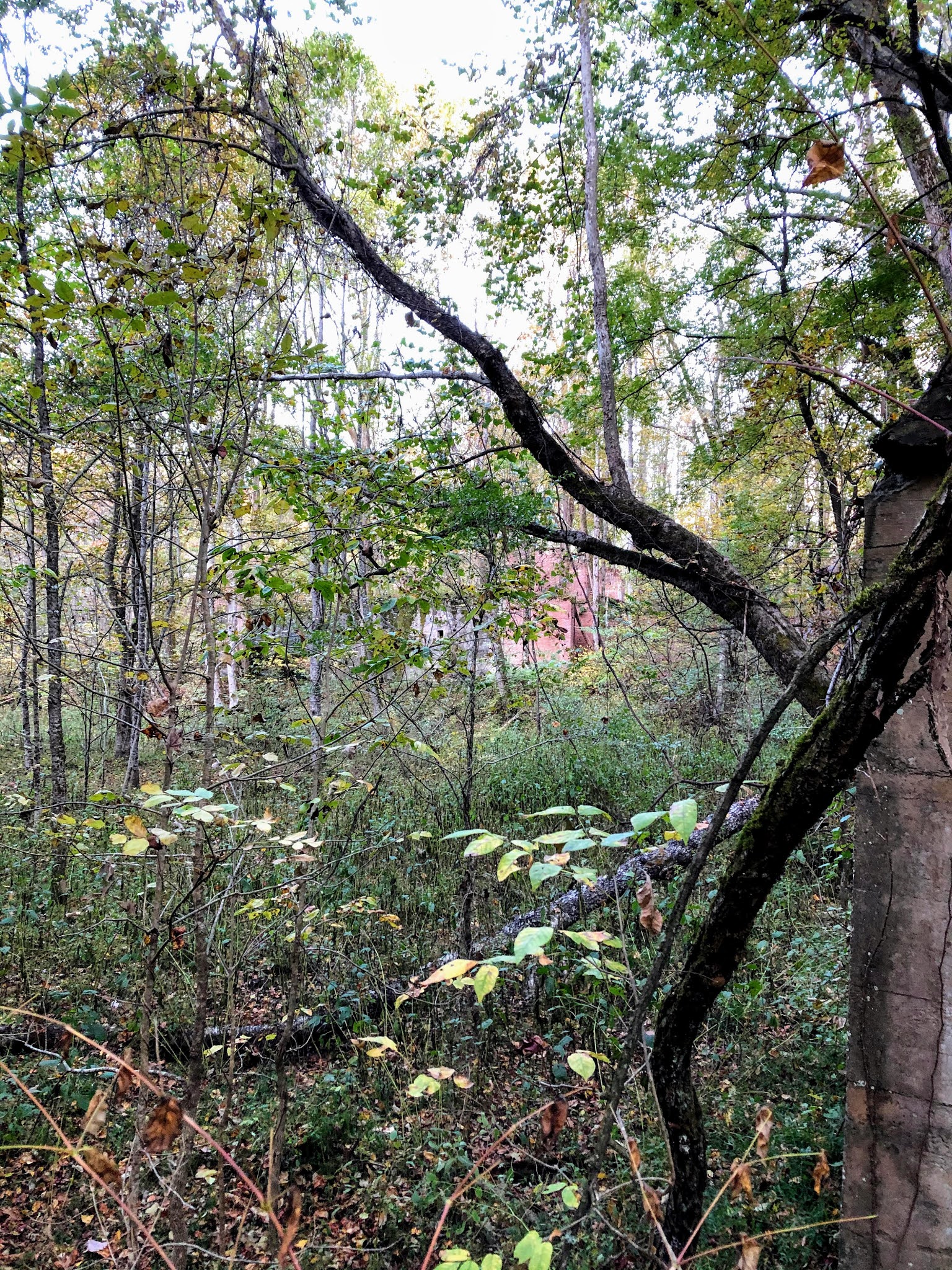 |
| HUGE concrete & brick building that was the dry kiln for the logging industry in Proctor |

 |
| Hazel Creek - Lakeshore trail junction in Proctor |

 |
| Grave marker for the Proctors - first white settlers on Hazel Creek |

I took a little time to hang out around the Calhoun house and look through the inside. They clearly had electricity and running water. The house sits right above the creek and has an old barn/stable nearby. There is an NPS building built behind the Calhoun house that seems to be a work building / bunk house.
As you follow the old road that is the Lakeshore trail west out of Proctor you follow the contour well above the Shehan Branch through Possum Hollow. The Proctor Cemetery is 0.5 miles from the Hazel Creek - Lakeshore trail junction on an obvious side trail with wooden steps leading up hill. The cemetery is large by Smokies standards. The site of the cemetery is the site of the original cabin built by the Proctors, and they were also the first residents of the cemetery.
Leaving Proctor, and heading west along the Lakeshore trail you are slogging through some mucky-marshy areas not far above the creek, and at mile 1.4 you reach the side trail to CS#88 (Possum Hollow). I didn't follow the trail down into the campsite, but did see a couple of folks at the creek collecting water that I assume had spent the night there in the campsite.
Lakeshore trail through this section rolls up and down, but trends more generally up until you reach the top of the ridge that separates Hazel Creek & Eagle Creek, after which it tends downward.
 |
| Lakeshore trail west of Proctor |

 |
| Old chimney just west of the Possum Hollow campsite |

Lakeshore trail makes its final descent toward Eagle Creek, which puts me back to where I had been just a couple of days before. From here on out I was retracing my steps back to CS#90, along Lost Cove creek, and then up and down over the ridges of Lakeshore trail on its way back to Fontana.
Phew... This was a tough section, no doubt. The "creek trails" on the NC side of the park like Eagle Creek, Hazel Creek, Forney Creek have become some of my favorites. They are not easy trails, but they have the exquisite beauty of an untamed mountain creek that captivates me. And so much neat history over in this area as well!
I am thankful for my friends Steve Larrabee and Andy Piercy who drove over to hike out and back on the Lakeshore trail for a few miles to join me as I made my way back to Fontana. It was great to have some company to hike with. And we went to Tapoco Lodge for burgers and fries afterwards, which is always a good thing after a long backpacking trip!
I am closing in on the last couple hundred miles of trails to complete. I'm basically working my way west to east now to finish off the NC side. Still hope to get one big trip in this fall / early winter. Hope you all are enjoying this beautiful fall weather and getting some hiking in.
Til next time, happy hiking!


No comments:
Post a Comment