New Miles Hiked: 20.7
Total Miles Hiked: 34.8
1-3 July, 2022
 |
| Day 1: blue, Day 2: orange, Day 3: red |
Really fun big loop! Some steep sections, but a lot of really nice cruising too. Love being at high elevation along Balsam Mountain and the AT. And, LOTS of rain. I had previously done the AT through here, as well as Hughes Ridge, but the rest of the loop was all new miles for me.
Day 1: Beech Gap I and Balsam Mountain trails to Laurel Gap shelter. 8.9 miles
Parked at the Beech Gap trailhead on Straight Fork Road, just as the 2-way round turns to 1-way. Hiked up Beech Gap trail to Beech Gap. To finish off all of the trails in this section I had to hike down the lower section of Balsam Mountain trail to Straight Fork Road at Pin Oak Gap, and then back up to Beech Gap. Then I hiked further on up Balsam Mountain trail to get to Laurel Gap shelter for night 1.
 |
| trailhead selfie |
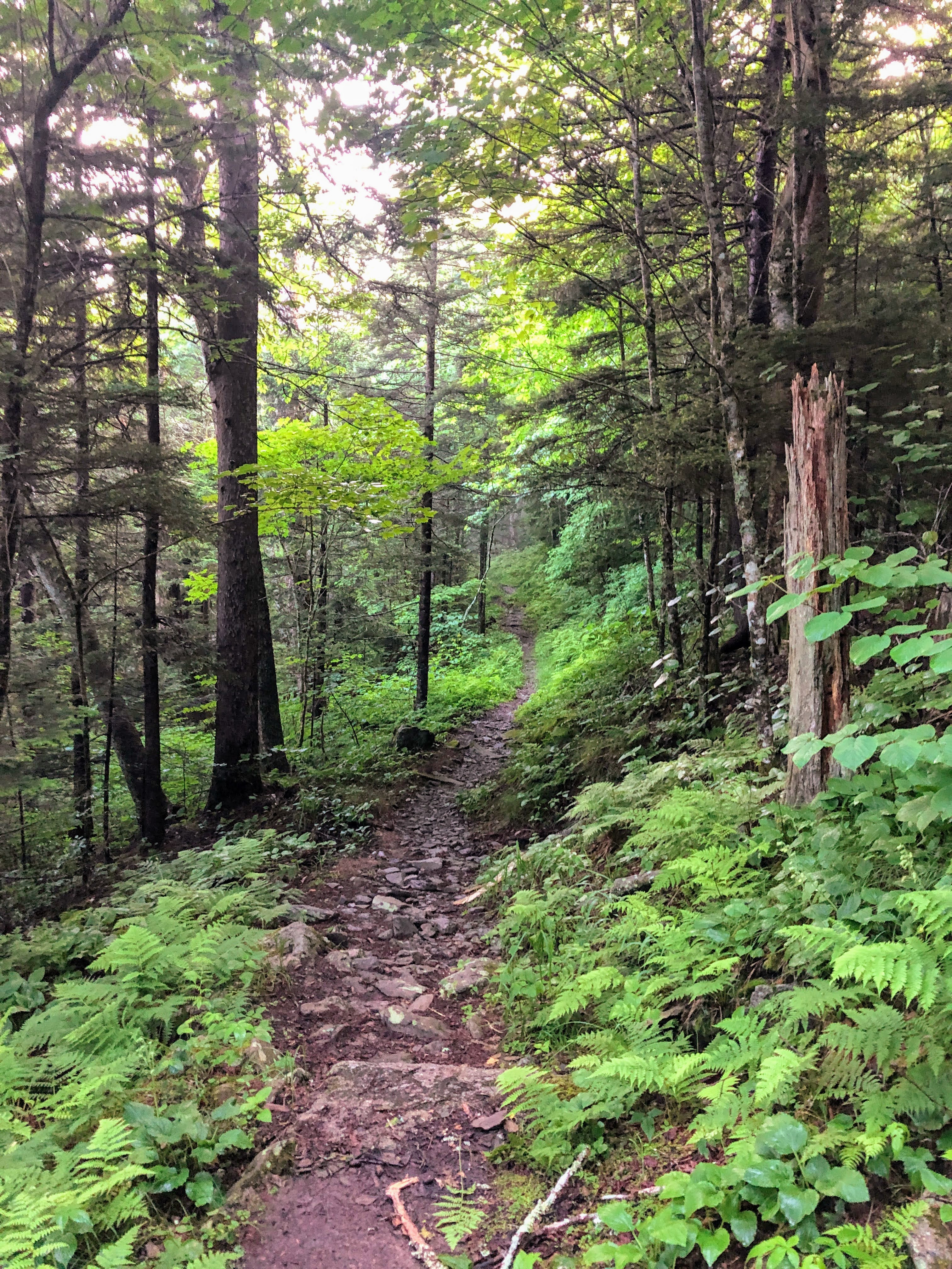
Beech Gap I trail is only 2.5 miles long, but gains about 2000' in elevation going pretty much straight up the whole time in to Beech Gap. Along the way there were lots of wildflowers to stop and admire. The Rosebay Rhododendron were in peak flower and were EVERYWHERE along the trails this whole trip. The Fire Pinks and Bee Balm were especially prolific and striking.
 |
| lots of wildflowers out! |
 |
| Beech Gap I trail. up, up, up... |
 |
| Beech Gap I trail. more up |
Beech Gap trail starts at about 3100', and as you gain elevation along the trail you rise into the "Northern Hardwood Forest" with beech, maple, and birch trees, but then also start to run into the occasional red spruce - a tree typical of the higher elevation "Spruce-Fir Forest" that dominates the highest elevations of the Smokies. Smells like Christmas!
 |
| Junction of Beech Gap and Balsam Mountain trails at Beech Gap |
I reached Beech Gap where the Beech Gap and Balsam Mountain trails meet. I needed to do an "out and back" on the lower section of Balsam Mountain trail to finish it off, so I descended 2.3 miles from Beech Gap back to the Straight Fork Road, and then turned around and hiked back up. Luckily, there is only about 700' of elevation difference on this trail, and it's not very steep.
 |
| Balsam Mountain trailhead at Straight Fork Road |
After making it back to Beech Gap, I continued on along Balsam Mountain trail another 2 miles toward the Laurel Gap shelter, which would be my home for the night. As you climb, the Red Spruce trees become more and more common.
 |
| Red Spruce along the Balsam Mountain trail |
Settlers in the Smokies used to call both Red Spruce and Fraser Fir "Balsam", but distinguished "He Balsam" (Red Spruce) from "She Balsam" (Fraser Fir) which is a close relative of the Balsam Fir. Lots of spots in the higher elevations of the Smokies have "Balsam" in their name.
 |
| boardwalks through mucky sections of trail |
The higher elevations of the Smokies also see a LOT more precipitation (both rain and snow) than the lower elevations. The higher average precipitation and lower average temperatures of high elevation gives rise to the particular plant communities of the Spruce-Fir forest. Lots of moss and fern and consistently wet soils. There are boardwalks through some of the particularly wet areas along the trail here, and also lots of evidence of the rooting of the feral hogs in the wet areas.
 |
| Laurel Gap shelter |
 |
| Laurel Gap shelter |
Finally arrived at Laurel Gap shelter. Shelters in the GSMNP are mostly along the Appalachian Trail. Other campsites in the park are open tent/hammock sites. Laurel Gap is one of just two shelters not associated with the AT (LeConte shelter being the other). I took advantage of the ability to stay in shelters this trip and didn't bring a tent, which shaved a few pounds off of my pack weight.
When I arrived, I was greeted by a group of campers from a nearby adventure camp who were out for a 5-day backpacking trip. 2 counselors and 5 13-14 year old campers. They were a hoot! Lots of fun to watch and listen to as they played card games, cooked, fetched water, and debated the best way to do everything. A little later, 3 brothers from Michigan came in to camp for the night. Shortly thereafter it absolutely POURED rain, sending everyone under the roof of the shelter. It was a pretty full house, but a pleasant evening.
Food note: I got a couple of different freeze-dried meals for dinners this trip. First night I had the Good-to-Go Thai Curry. It was pretty good. A few too many Thai spices for me (not hot - just the flavors), but overall not bad. I wanted to try something different than my usual Mountain House meals.
Day 2: Balsam Mountain and Appalachian Trail - Laurel Gap shelter to Pecks Corner Shelter. 11.7 miles.
Got up and out about 7 am. I was the only one up when I left - everyone else was still snoozing! Had my usual coffee & oatmeal breakfast, but also threw in a lemon Lara bar, and hit the trail.
Heading north from Laurel Gap shelter on Balsam Mountain trail you shortly reach junctions with the Mt. Sterling Ridge trail (0.2 mi), and then the Gunter Fork trail (1.1 mi).
 |
| Balsam Mountain - Mount Sterling Ridge trail junction |
 |
| Balsam Mountain trail through the Spruce-Fir forest |
 |
| Cool rock outcrop with a tree growing on top |
 |
| Balsam Mountain - Gunter Fork trail junction |
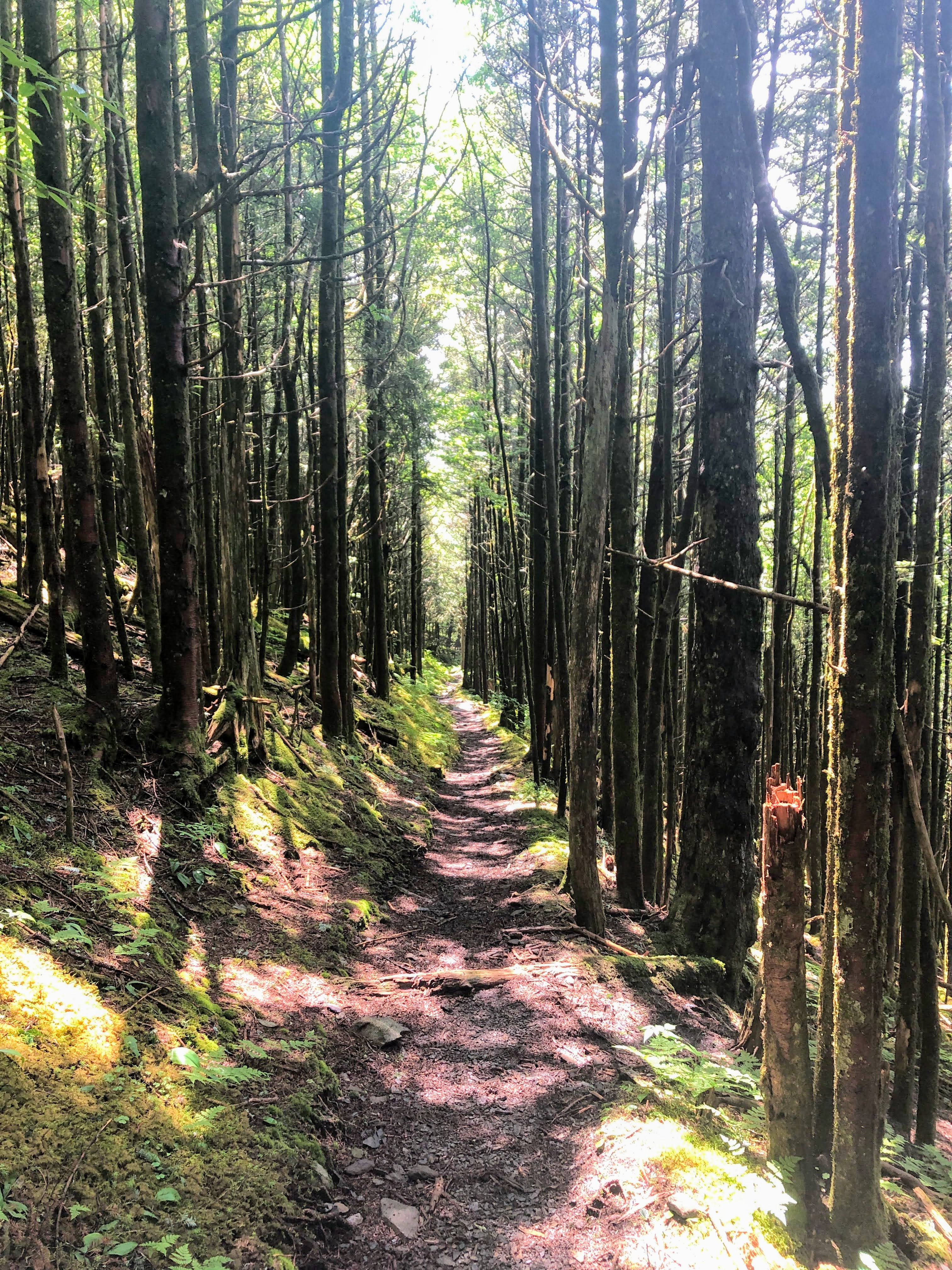
At this point the trail has reached about 5500' elevation and it cruises along at about this same elevation all the way to the AT. So really nice hiking through Spruce-Fir forest (mostly Red Spruce, just a few Fraser Fir).
 |
| A path through the ferns |
 |
| Baby Fraser Fir tree |
About mid-morning the skies began to darken, the mist through the trees became more prominent. Rain had been predicted for most of the weekend, and is definitely more common at elevation, so I was mentally prepared to get dumped on. Mother Nature did not disappoint. About a mile from the AT the skies opened up and it rained HARD. I pulled out my pack cover and rain coat and trudged on through the downpour. The trail turned into a flowing creek with water over the tops of my shoes in places.
 |
| Misty morning - just before the rain began |
 |
| Balsam Mountain - Appalachian Trail junction |
 |
| The trail (aka creek) during the rainstorm |
I reached the junction with the Appalachian Trail and turned left (west). Just about a tenth of a mile down the AT is the Tricorner Knob trail shelter. It was only 11 am, I had already gone about 6 miles, and only had about 5 miles left of my day, SO I decided to pop in to the shelter for lunch, and a nap!
There was nobody else at the shelter when I arrived to get out of the rain. I took off my wet shirt, and put on a dry one, ate a snack, and sat down to read the shelter log. The log started back in March 2022, so there were lots of entries from AT thru-hikers talking about snow, cold temperatures, and how weird Gatlinburg is :-) Very amusing! After snacking & reading I got out my sleeping pad, sleeping bag, and pillow and laid down for a nap. Not too long after I laid down a group of 3 guys from Ohio came in, this was their final destination for the night. Then a peak-bagger (and his dog :-/) looking for Mt. Guyot stopped in for a second (I assume he was doing the SB6K challenge). Then another multi-day backpacker stopped in for a while to dry off and eat. Then a group of day-hikers stopped in... It was a very busy place on a rainy day! I never did get a an actual nap, but I did get warm and dry, and enjoyed chatting with the folks who stopped in.
The rain eventually let up, and the sun peaked out, so I decided to get on the trail while it was dry. I had done this section of the AT previously with my friend Shane, when we hiked from Newfound Gap to Davenport Gap in June of 2013. But the AT always has a hold over me, and I always love a chance to hike on it. Currently planning my thru-hike for Spring/Summer/Fall of 2033...
 |
| Appalachian Trail |
 |
| High elevation wildflowers |
The wildflowers were plentiful along this section of Balsam Mountain trail and down the AT. There are several species that are only found at higher elevation in the Smokies. Rosebay Rhododendron was still common, as it is at most elevations of the Smokies. But Rugel's Ragwort was just starting to flower, I saw a few plants of Southern Bush Honeysuckle, Bluebead Lily was all in fruit. AND I got to see the newly named Smoky Mountain Rhododendron which only grows at the highest elevations in the Smokies on exposed ridges. Pretty botanically cool!
 |
| Appalachian Trail through a tunnel of Red Spruce |
There's a really cool stretch of the AT near Eagle Rocks where the trail skirts the highest edge of the ridge. It's a rock outcrop above a sheer cliff that hovers over an inaccessible valley. REAL untouched wilderness... And absolutely amazing views from the trail.
 |
| View north from the AT near Eagle Rocks |
 |
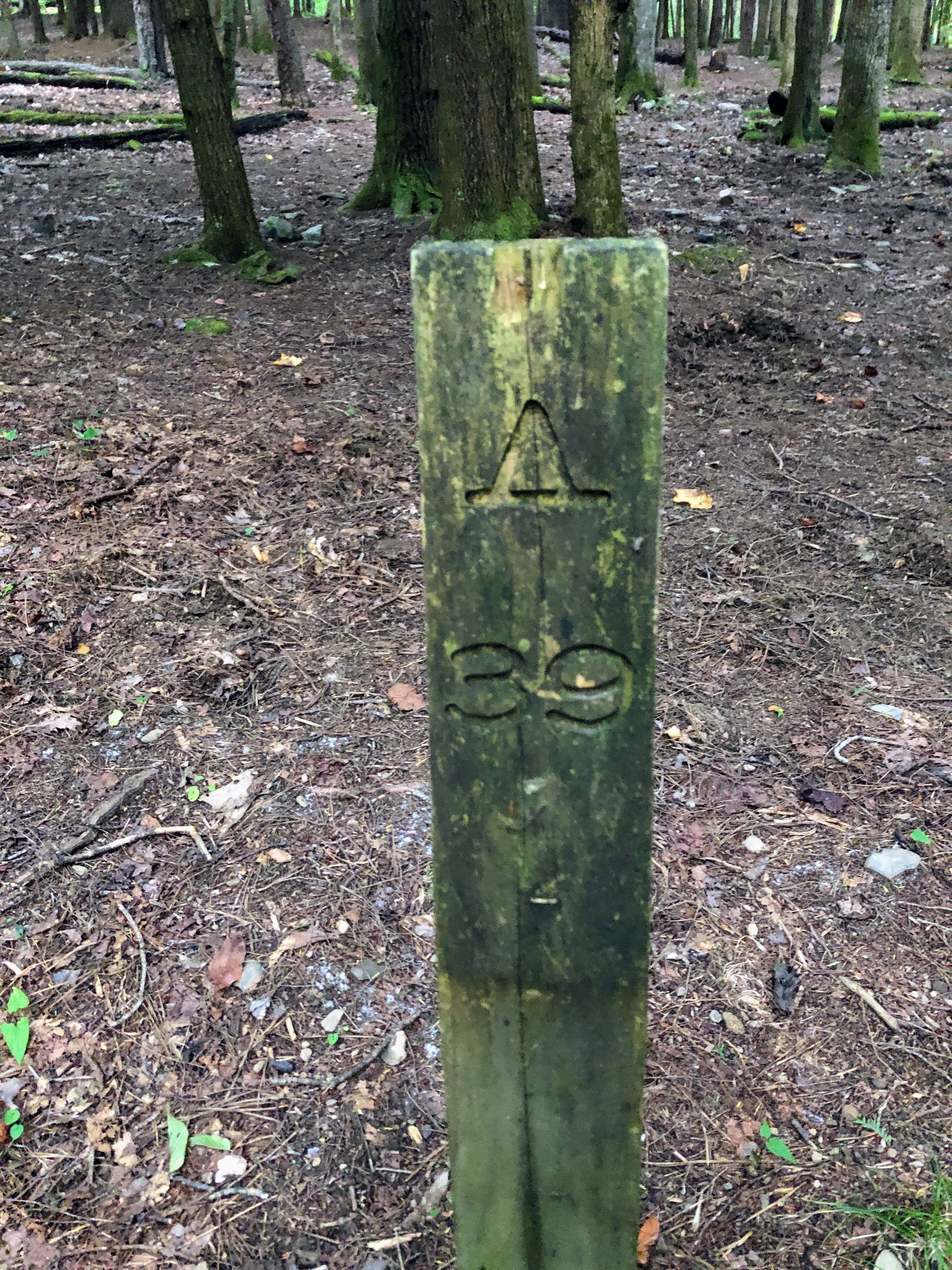
| White blaze of the Appalachian Trail |
Finally reached the Hughes Ridge trail and turned left (south) down toward Pecks Corner shelter. To the consternation of many AT thru-hikers, this shelter is 0.4 miles off of the AT, and fairly steeply down. Which means it's fairly steep back up the next day to get back to the AT. Subsequently, a lot of thru-hikers skip this shelter in favor of moving on to Tricorner Knob shelter.
 |
| Appalachian Trail - Hughes Ridge trail junction |
 |
| Hughes Ridge trail heading down |
 |
| Pecks Shelter sign |
I reached Pecks Shelter around 4 pm, and thankfully had a dry afternoon of hiking after my very wet morning. There were a few other folks already at the shelter when I arrived (including another backpacker I had met at Tricorner Knob earlier that day - hello Gary from Mississippi!). I set up in the shelter again, taking advantage of the ability to hike without carrying my tent. Others were going back and forth between tenting/hammocking outside the shelter vs. staying in the shelter, mostly because of the potential for more rain.
Most backpackers I've met really don't like staying in the shelters. There are often critters to deal with: usually mice who eat the crumbs left by hikers; sometimes snakes (rat snakes that eat the mice that eat the crumbs...); and occasionally a bear who is also interested in hiker food. It can also be hard to sleep in the shelters when other folks are snoring, or rolling over on their loud, crinkly air mattresses, or are up late talking or going to the bathroom. But regardless, they are great gathering spots for hiker conversation and community. I sat through the evening chatting with other hikers about gear, food, other trips we had done, other trips we hoped to do... It was a really fun evening. Climbed into my sleeping bag when it stared to get dark and chilly, and went down for the night.
Food note: Tonight I had the Good-to-Go Pad Thai. Very good! Comes with a little baggie of crushed peanuts to add in. I also like the Good-to-Go dinners because they are 1 serving, as opposed to Mtn. House which are typically 2 servings, and too much for me to eat alone.
Day 3: Hughes Ridge to Enloe Creek to Hyatt Ridge to Beech Gap II trails. 14.2 miles
Final day on the trail, and longest of the trip. Got up, had breakfast, and packed up. Gary from Mississippi was headed the same way I was so we hiked together for the morning.
Hughes Ridge trail descends gradually from the AT and on the way passes the Bradley Fork trail coming in from the west, then meeting up with the Enloe Creek trail coming in from the east. As you drop in elevation you lose more and more of the Spruce trees and the trail gets drier and drier. While there are some rocky & rooty sections, for the most part it's a pretty pleasant path.
 |
| Hughes Ridge trail |
 |
| Hughes Ridge - Bradley Fork trail junction |
 |
| More summer wildflowers |
At the Enloe Creek junction we turned left (east) on to Enloe Creek trail, and new miles for me. Enloe Creek seems less well used than Hughes Ridge, and was certainly overgrown in sections. The trail follows its namesake creek which you can hear and see from above as you hike. It's a fairly large creek, with some cool cascades, pools, and boulders. Very picturesque.
 |
| Hughes Ridge - Enloe Creek trail junction |
 |
| Enloe Creek trail was a little overgrown in spots |
There is one creek crossing that is unbridged about a mile before Campsite #47. Maybe it would be an easy rock hop if we hadn't had much rain, and I did make it about 1/2 way across before deciding that it would be smarter to have wet feet than to fall and break my leg on a slick rock...
 |
| Creek crossing - rock hopped half way, but then just walked through |
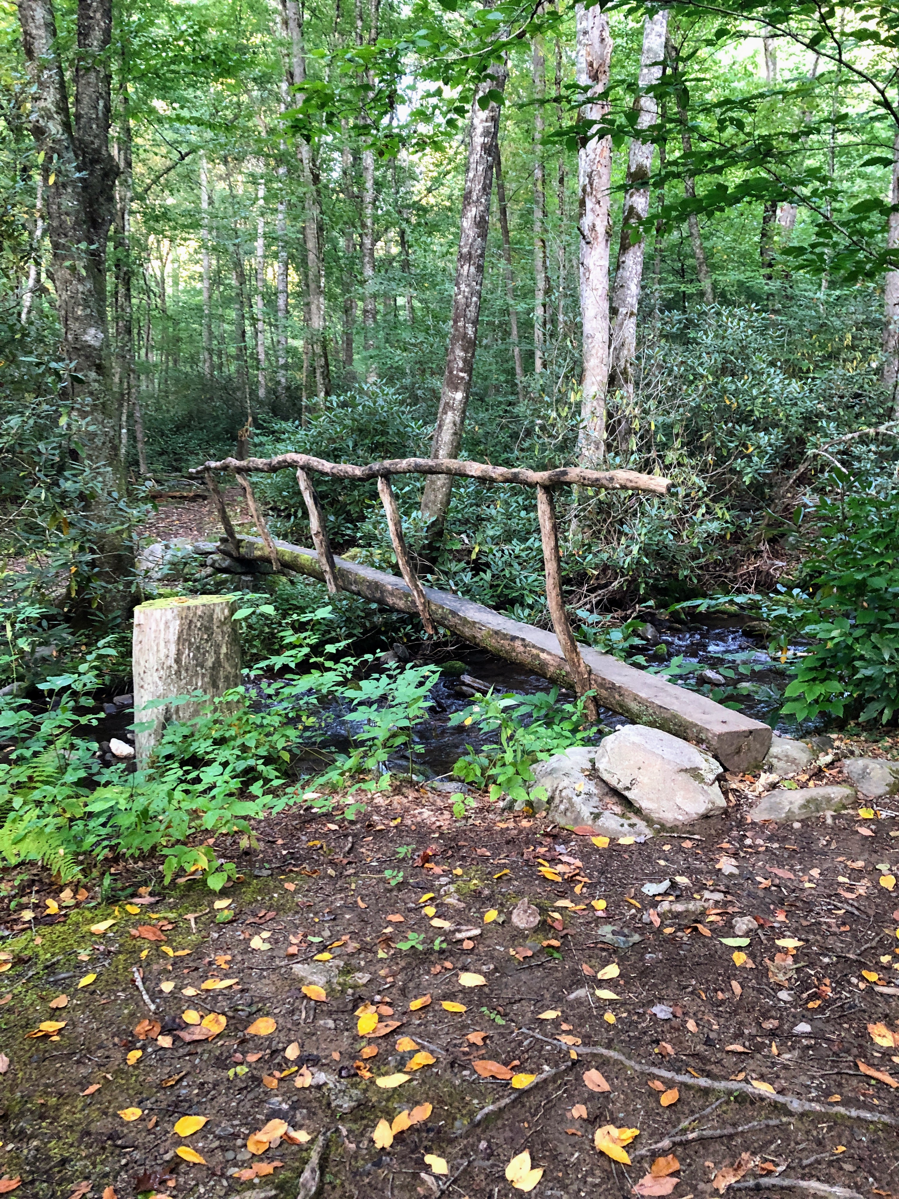
The trail bottoms out at backcountry campsite #47 - Enloe Creek campsite. While the campsite itself is small, and kind of muddy, the surroundings are beautiful!!! It sits just above a bend in the Raven Fork, a large creek that drains this valley. There is a metal footbridge spanning the creek, and huge boulders, fallen trees, cascading water, beautiful Rhododendrons... It's really a pretty magical spot.
 |
| Backcountry Campsite #47 - Enloe Creek |
 |
Backcountry Campsite #47 - Enloe Creek
|
 |
Backcountry Campsite #47 - Enloe Creek
|
 |
Bridge over Raven Fork at Enloe Creek campsite
* notice the bear cables attached to the bridge * |
 |
| Rosebay Rhododendron over Raven Fork |
 |
| Raven Fork |
 |
| Bear pole for hanging packs at Enloe Creek campsite |
The food hanging system here is unlike any I've seen in any other GSMNP campsite. There are a couple of bear cables, but they are attached to a pole hanging from the bridge, rather than being suspended between two trees as usual. AND there is a bear pole with a metal rod for lifting & hanging your pack as an alternative. I've heard of these and seen pictures from some AT campsites further north, but I'd never actually seen one in person. Looks like a fun game to try!
From campsite #47 Enloe Creek trail climbs STEEPLY up toward its junction with Hyatt Ridge trail. It's about 800' of elevation gain over a mile, and it wore me out! It was warm, and very humid, so I was quite literally dripping sweat by the time I made it to the top.
 |
| Enloe Creek UP out of campsite #47 |
I had been hiking with Gary up to this point, but he was faster than me, and had farther still to go, so we parted ways at this trail junction, and he moved on up Hyatt Ridge. I enjoyed hiking with him, and look forward to the possibility that we might see each other out on the trails again.
 |
| Enloe Creek - Hyatt Ridge trail junction |
Having just climbed UP from Enloe Creek, I was NOT looking forward to Hyatt Ridge which features more uphill. The first half-mile or so of this section is brutal. There are 3 or 4 climbs that are just straight up - not terribly long, but STRAIGHT UP. I was cursing the trail builders for this one.
 |
| Rock Tripe - a lichen, growing on a trailside boulder |
 |
| Hyatt Ridge trail: straight up |
BUT, luckily, once you make it through that first part the trail levels off and becomes a pleasant stroll through the woods for the middle section. It then climbs steeply for a bit again as it approaches the junction with Beech Gap trail.
Ultimately, I would take the Beech Gap II trail down to Straight Fork Road to finish my hike, but first I needed to take the 0.9 mile section out to the end of Hyatt Ridge to campsite #44 - McGee Spring campsite.
 |
| Hyatt Ridge - Beech Gap trail junction |
I'll be honest - the 0.9 miles felt a lot more like 5 miles... The trail rises to a ridge, then back down the other side. It wanders this way and that. Maybe I was just tired, but if felt like I would *never* get to the end! Finally stumbled in to campsite #44, and was thoroughly unimpressed. The little brown book call it an "enchanted glade" - it felt more like a damp, buggy, muddy spot, with few good flat tent spots. I was not enchanted, and have no wish to spend a night here. (but maybe I was just tired...)
 |
| Backcountry campsite #44 - McGee Spring |
 |
Backcountry campsite #44 - McGee Spring
|
From here I retraced my footsteps back to the trail junction with Beech Gap II, and headed down. Beech Gap II is like the mirror image of Beech Gap I. It drops steadily about 2000' from Hyatt Ridge trail down to Straight Fork Road. Mostly ridge-side hiking as the trail descends. Some nice wildflowers, and a good trail. But I was ready to be done and my feet were sore. So I was happy to see the road through the trees as a I approached the trailhead. A short road walk up hill to the Beech Gap I trailhead and I was done!
 |
| Done! Finished at the bottom of Beech Gap II |
So: really great 3-day / 2-night trip. Loved the high elevation hiking. Fantastic wildflowers. Fun in the trail shelters, meeting & chatting with other hikers. And a big chunk of new miles complete.
I have a bunch of trails in Cataloochee, plus a chunk of Lakeshore/Noland Creek/Noland Divide, and then Boulevard trails to wrap this journey up. Looking forward to getting this quest completed, and to seeing more amazing trails in the park.
Til next time, happy hiking!


