New miles hiked: 11.1
Total miles hiked: 24.6
17-18 Sept. 2022
 |
| Day 1 in red, day 2 in blue. Spent the night at CS#39 |
Finished off a few more trails in the Cataloochee - Mt. Sterling area this weekend. The trailheads for the Mt. Sterling and Little Cataloochee trails are fairly close on Old NC 284 (aka Mt Sterling Rd) which made it convenient to get them all done on the same trip.
The Mt Sterling Rd is a narrow gravel road the skirts the eastern end of the park. I accessed it from the Waterville exit of I-40. The distance is not huge, but it's a SLOW road - 15-20 mph most of the way, so it took a while to get to the trailhead (and my car is covered with dust)!
 |
| Trailhead selfie |
Parked at the Mt. Sterling trailhead with a bunch of other vehicles. It's apparently a popular day hike. Passed a bunch of folks on the trail, and saw some folks setting up camp at CS#38 near the summit of Mt. Sterling. The trail isn't long (just 2.7 mi) but it's steep - gaining about 2000' in elevation.
 |
| Some of the fall wildflowers and leaves starting to turn |
Fall wildflowers were out in abundance. Fall asters, snakeroot, and Gentians were out. And the witch hobble leaves were starting to turn their lovely maroon-purple, leaving some cool patterns on the leaves.
 |
| Mt. Sterling - Long Bunk trail junction |
The first bit of trail, up to the junction with the Long Bunk trail, isn't too steep. Once you pass that trail junction though it's all up, up, up. And the trail is rocky - the kind of rocks that are just big enough to turn your ankle on if you're not paying attention.
 |
| Mt. Sterling trail: rocks, rocks, and more rocks! |
 |
| Mt. Sterling - Mt. Sterling Ridge trail junction |
About 2.3 miles from the trailhead you reach the junction with the Mt. Sterling Ridge trail which comes in from the left (southwest). The Mt. Sterling trail continues to the right, following the ridge up to the summit, CS#38, and the fire tower.
I'm a little sketchy with heights, but thought I'd surely be ok going up the tower. I had gone up others, like Shuckstack with no problem. But as I climbed, and saw the platforms with no rails or bars, my knees started to wobble and I decided that going up two flights was enough. I took a couple of pictures from the 2nd platform and turned back down.
 |
| View from the top of Mt. Sterling |
 |
Mt. Sterling - Baxter Creek trail junction
|
Just a few feet beyond the base of the fire tower is the end of the Mt. Sterling trail where it reaches its junction with the Baxter Creek trail, which follows the ridge down to Big Creek. Nice view off of the side of the ridge from here.
I had more driving and more hiking to do today, so I turned back down to hike back to my car pretty quickly. Tough hike up, but cool to see the fire tower and the views!
Drove a few miles down the road and parked at the trailhead for Little Cataloochee trail. I was looking forward to the historic structures and areas of this section and they didn't disappoint. I was not looking forward to the climb up & over Davidson Gap. This also did not disappoint. 😳
 |
| Trailhead selfie |
Little Cataloochee valley is a narrow and steep valley just north of Cataloochee Valley. It was settled later than Cataloochee, but apparently pretty heavily. Lots of farms, apple orchards, and communities along the road through the valley.
 |
| Lobelias in flower EVERYWHERE! |
 |
| Little Cataloochee trail is a gravel road for the first couple of miles |
The first couple of miles of the Little Cataloochee trail is a gravel road, and presumably used by the park service to maintain the historic structures in the area. There are some steep ups and downs at the beginning, but they're mostly pretty short.
 |
| Little Cataloochee - Long Bunk trail junction |
About a mile in you reach the junction with the Long Bunk trail which comes down from the north where it begins along the Mt. Sterling trail. There is a large cemetery (Hannah Cemetery) just north of this junction, along the Long Bunk trail.
 |
| Hannah Cabin |
 |
| Hannah Cabin |
The first historic structure you reach is the Hannah Cabin, just up the hill from the trail. One big room below, and a loft above with a front and back porch. If you notice the chimney in the picture you'll see that it's brick which is fairly unusual. Most chimneys in the park were made with stacked stone.
 |
| More fall wildflowers and berries |
More beautiful fall wildflowers along the trail. Thistles, and Jewelweed, Yellow Crownbeard, and Doll's Eyes in fruit (poisonous berries).
 |
| Springhouse |
Along the way I saw a lot of other evidence of prior habitation. Old paths that led up to home sites, sometimes even with posts flanking the path. Yucca plants (a favorite ornamental of pioneers, but not native to the area, so they always stick out). Even saw one constructed rock springhouse, right at the entrance to a home site and along the main road.
 |
| Little Cataloochee church. |
Next you pass the Little Cataloochee church. This frame-built church looks like it's still in fantastic shape. Bright white and shining, both inside and out. There's a cool bell-tower (complete with a bell), and a larger cemetery next door. I could just envision how this place must have been the community center for this valley.
 |
| Dan Cook Cabin |
The final historic structure you pass is the Dan Cook Cabin, a one-room cabin with a loft and a wrap-around front porch set in a wide yard with a split rail fence! This is also the end of the road, and from here on the trail reverts to typical smokies single-track type trail.
 |
| Trail becomes single track beyond Dan Cook Cabin |
This is also where the trail starts to climb up toward Davidson Gap, the high point of the trail at about 3800' elevation. The climb from Dan Cook Cabin up to Davidson Gap happens over about 3/4 of a mile and gains about 600 feet. It's a bit steep, and I was quite happy to reach the gap!
 |
| Climbing UP toward Davidson Gap |
From Davidson Gap down toward Pretty Hollow Gap trail is equally (if not more) steep, rocky and very wet. So I was happy to reach the Pretty Hollow Gap trail where I turned right (north) for about 1 more mile to reach backcountry campsite #39 (Pretty Hollow), which would be my home for the night.
 |
| Little Cataloochee - Pretty Hollow Gap trail junction |
 |
| Pretty Hollow Gap is ROCKY! |
 |
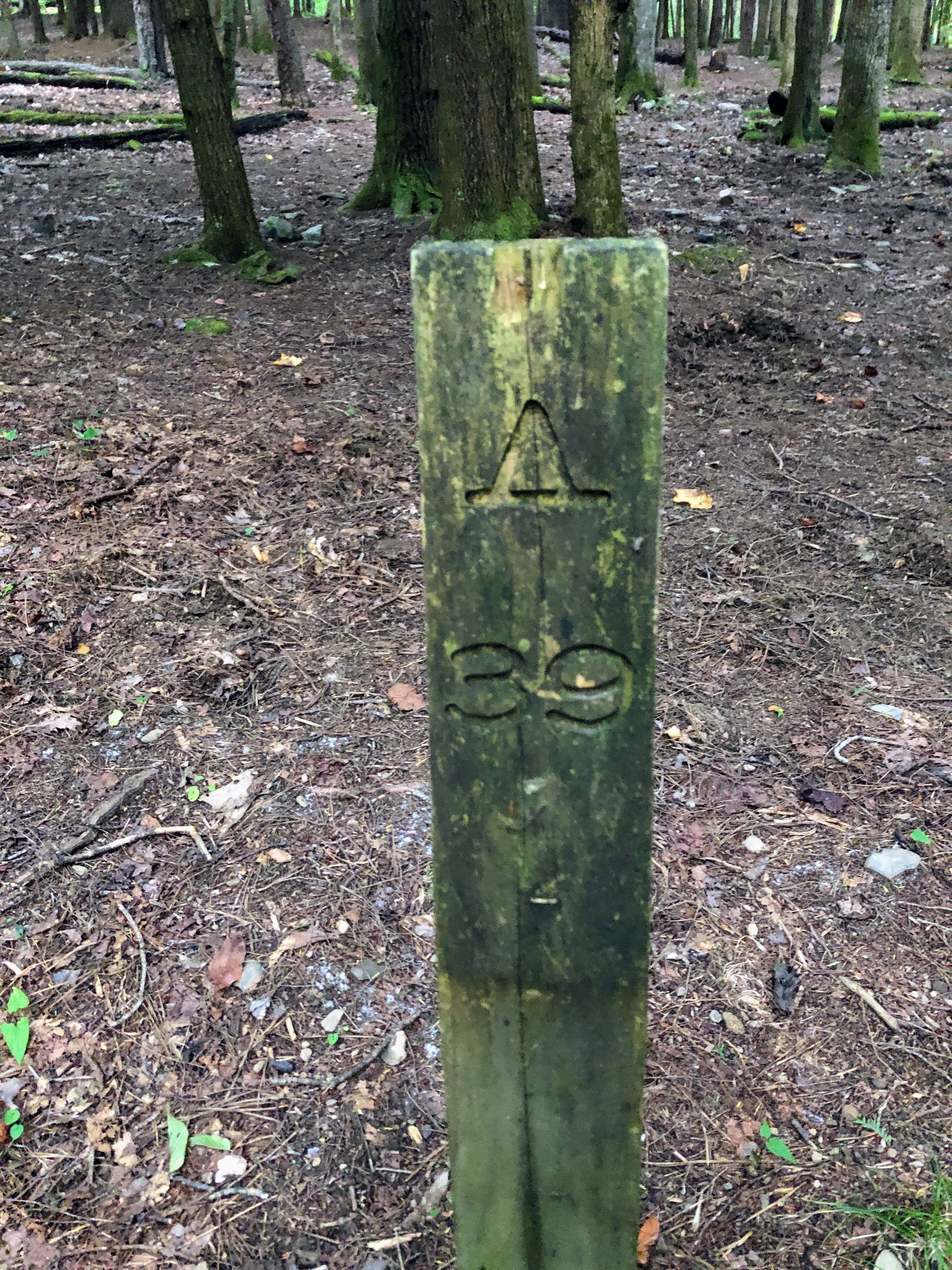
| Backcountry CS#39 |
I reached the campsite around 6 pm, and settled in to do camp chores. Filtered water (the creek runs right along the bottom edge of the campsite), set up my tent, cooked dinner (Mountain House beef stew), and got a little campfire going. Campsite #39 is large, but much of it is on the side of the hill, so finding a flat tent spot can be challenging. There are several official fire rings and at least a couple of sets of bear cables. I chose a site near the top of the hill. I managed to stay up until about 10 pm watching the fire.
 |
| Cheery little campfire |
Sadly, CS#39 is heavily damaged by wild boars. Much of the trail and the campsite in this area is plowed up and highly disturbed.
 |
| Wild boar damage in CS#39 |
The next morning my hike included an out and back on the Palmer Creek trail, and then backtracking on the Little Cataloochee trail to the trailhead. Because I would be coming back this way, I opted to leave a bunch of my gear in the campsite on the bear cables, and just carried my pack with food, water, and my 10 essentials bag.
 |
| Beginning of the Palmer Creek trail at its junction with Pretty Hollow Gap trail |
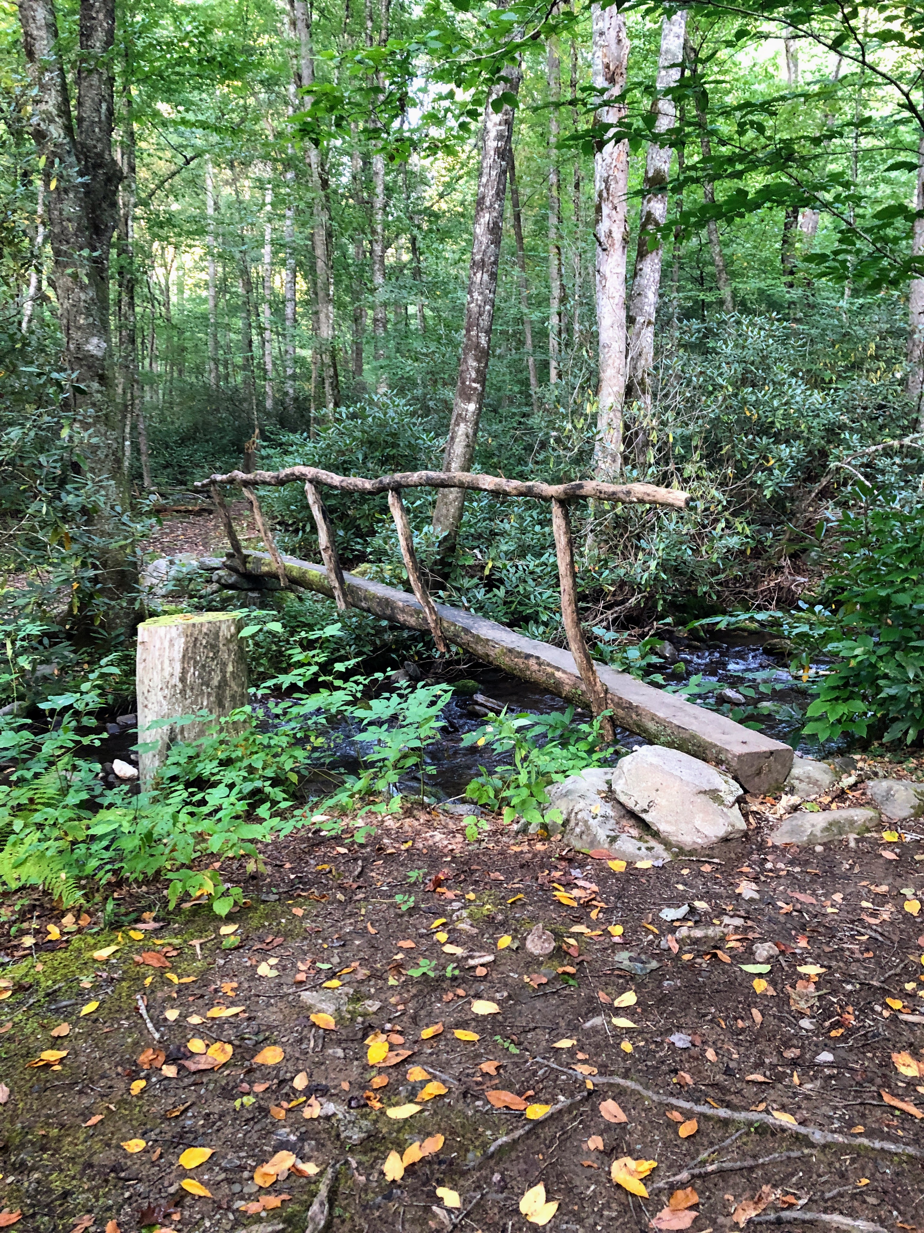
Palmer Creek trail runs 3.3 miles from Pretty Hollow Gap up toward Balsam Mountain Road. It follows the creek most of the way, although mostly high up on the ridge above the creek. So you can almost always hear the creek, even if you can't see it. There are 3 creek crossings - and while the little brown book says there are bridges on all 3, only the first two still actually have bridges. The Beech Creek crossing is a rock hop.
 |
| Log bridge over the creek |
The first creek crossing is right at the trail beginning, and then the trail starts up the valley. For about the first mile and half, it's super-cruisy. While the trail is narrow, it's flat-ish and nicely packed dirt without lots of rocks and roots. It was early morning when I was there and the sun was shining up the valley making awesome patterns through the trees.
 |
| Palmer Creek trail is narrow and high on the ridge above the creek |
 |
| Unbridged crossing of Beech Creek |
The final creek crossing is at Beech Creek - I thought I had a good rock-hop path over it, but my foot slipped on a wet rock, so I had a wet left foot for the rest of the day.
 |
| Moss-lined trail near the top |
From Beech Creek on up the trail leaves the creekside and starts up the ridge in earnest. It's steeper here, although the trail is still easy walking. There are places where it's deeply rutted, though. Also several sections of Rhododendron tunnels.
 |
| End of Palmer Creek trail at Balsam Mountain Road |
Palmer Creek trail tops out at Balsam Mountain Road, and I stopped here for a quick snack and drink. Saw one of the few sets of other hikers I saw all day here. They were coming down Balsam Mountain Road, presumably from Pin Oak Gap which is just about 0.7 miles up the road.
 |
| More wildflowers: Cucumber Root, American Spikenard, and White Turtleheads |
 |
| View of a small cascade on Palmer Creek |
From Balsam Mountain Road I turned back around and headed down. Easy-peasy trip back to the campsite. I stopped at the campsite for another snack, and then packed up the rest of my gear getting ready to head back to the car.
 |
| Little Cataloochee trail / creek |
The trip back was uneventful. The climb up Davidson Gap from this side was even steeper and tougher than the climb from the other side. Also, much of the trail on this side of Davidson Gap is very rocky and often the trail and the creek are intermingled, making the hiking tough and sloppy.
 |
| First signs of Autumn - red maples are turning! |
It was a good late summer / early Autumn trip! Happy to check a few more trails off the list, and neat to see the fire tower and the cabins & church in Little Cataloochee valley. The days were warm (80s) and the night cool (50s), and the beginning signs of Autumn were evident. Fall is my favorite time in the mountains!
Til next time, happy hiking!


