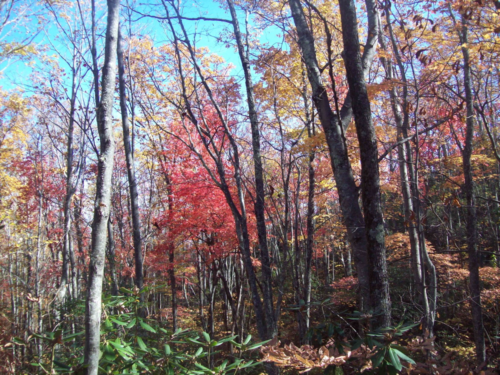
Friday, March 23, 2012

Sugarland Mountain Trail

New Trail Miles Completed: 12.0
Total Trail Miles Hiked: 12.0
23 March 2012

OH. MY. GOSH.  It's been almost 3 months since I added any new trail miles to my quest.  It's been 2 months since I've been out hiking.  I have been doing lots of running and going to the gym, but it's just not the same...

So finally today I got to get out and do a new hike with my buddy Shane.  Out of bed at 5 am, on the road by 6 am (thanks for the shuttle Sarah K!), and at the trailhead by 8 am.  Sugarland Mountain trail runs for 12 miles from Clingman's Dome Road (~ 6000 feet elevation) down to Fighting Creek Gap on the Little River Road (~ 2300 feet elevation).

Shane & me at the start of our hike

This was a cool trail to do today because spring is definitely here and I wanted to get an idea of how far along the wildflowers are.

Here are some of the flowers we saw today:
Spring Beauty, Sweet White Trillium, Yellow Trillium, Trailing Arbutus, Smooth Rock Cress, Blood Root, Squaw Root, Rue Anemone, Meadow Rue, Speckled Wood Lily, Lousewort, Squirrel Corn, Cut-leaved Toothwort, Mayapple, Large-flowered Bellwort, Trout Lily, and Blue Cohosh.

Trailing Arbutus

Yellow Trillium

The weather today was off and on rain.  Up on Clingman's Dome Road it was foggy and misty in the morning which just added to the Spruce-Fir forest mystique that make the high-elevation Smokies so amazing.  We ran into several AT thru-hikes early on - you have to take the AT for a few tenths of a mile to get to the start of the Sugarland Mountain trail.

Appalachian Trail sign-post

They had all stayed at the Mt. Collins shelter last night and seemed in good spirits despite the early morning rain.

Mt. Collins Shelter

The upper parts of Sugarland Mountain trail meander through Spruce-Fir forest with occasional great views across the valley.


4.8 miles down-trail the Sugarland Mountain trail reaches its junction with the Rough Creek trail.  From a clearing near the trail junction you can look back and see the Chimney Tops.  [and by the way - the trail to Chimney Tops will be closed Mon-Thurs for the 2012 season starting at the end of April]

Sugarland Mtn - Rough Creek trail junction

Chimney Tops

From here the trail continues to descend, and we walked through a couple of amazing wildflower spots.  Spring is SOOOOOO early this year - it's amazing to be seeing Trilliums in March!  For the most part the Sugarland Mountain trail is a "typical" Smokies trail: fairly narrow, eroded a few inches below the surrounding round level, and full of rocks and roots.  It's a well-maintained trail in general, although we did have to cross a number of downed trees of various sizes.

Toward the end of the middle section (between Rough Creek trail & Huskey Gap trail) we stopped at Campsite #21 for lunch.

Campsite #21 marker

There's a lot to recommend about Campsite #21.  Right now the wildflower display is amazing!  It has 2 sets of cables for hanging food away from the bears.  There is a nice water supply now that apparently diminishes quite a bit during the drier months of the year.  The site is situated in a very cool boulder field and there is a LARGE boulder with an overhang that provided a nice respite from the rain today.

Overhanging boulder at Campsite #21

The one thing that Campsite #21 does NOT have?  Any decent tent sites...  The campsite sits on the side of a hill, and amidst a boulder field.  The few flat spots available are (a) very small, and (b) pretty wet during the spring.  It's a really cool site, and would be fun to stay at, but not if you had a lot of people or big tents.

After lazing away an hour or so having lunch and looking at wildflowers we saddled up and headed on down the trail.  Not too long after lunch Shane spotted something off in the woods that just didn't look natural, so (of course!) we had to investigate!  As you can see, it turned out to be...


a "FOR SALE" sign???  How in the world does a for sale sign end up deep in the woods of the Smokies...  Shane reckons that it was brought in by tornado back in April.  Works for me.  Regardless, it's now on it's way to the landfill.

Eventually we reached the Sugarland Mountain - Huskey Gap trail junction which put us just about 3 miles from the end of the trail.

Sugarland Mountain - Huskey Gap trail junction


Along this section there were several nice views back up the valley toward the tops of the mountains, and the wildflowers were just amazing.  By now the rain had pretty much gone away, and the temperatures had warmed up.  What a great way to celebrate the beginning of spring and to get a chance to get out on the trails with Shane.


It will hopefully NOT be another 3 months before I get out on the trails again.  I'm enjoying the beginning of spring already and I'm looking forward to a highly productive spring / summer hiking season!


Til next time - happy hiking!


Monday, December 26, 2011

Birthday Hike - Twin Creeks Trail

New Trail Miles Completed: 1.9
Total Trail Miles Hiked: 3.8
26 Dec. 2011

Today is my birthday!  So I gathered up my boys (18 and 11 years old respectively) and we headed down to Gatlinburg.  I wanted something nice and easy for today - just a chance to get out and spend some time on the trail with my sons.


Twin Creeks trail is just under 2 miles long and parallels Cherokee Orchard Road just inside the park from Gatlinburg.  We started our hike at the trailhead near the park boundary, just as Cherokee Orchard Road enters the park.  The trail travels along an area that was heavily settled before the park, and you can see numerous reminders of the previous inhabitants in the form of rock walls and fallen-down chimneys.


The trail also parallels LeConte Creek for much of the way and it was full of water and joyously noisy today.


Along the way we almost ran into (literally) a doe that seemed completely unperturbed by our arrival.  All three of us walked to within 5 feet of her and she just stood and watched us and then meandered away.


The Twin Creeks trail passes by the fairly new Twin Creeks Science & Education Center.  This is a great facility that helps park and associated scientists both do research within the park and share that research with area students.


Finally, the Twin Creeks trail runs into the Noah "Bud" Ogle Nature trail that leads back toward Cherokee Orchard Road and the Noah "Bud" Ogle Cabin.  This little plot contains both a cabin (which appears to actually be a hybrid of 2 cabins stuck together) and a barn.  Both are typical of the construction of the Smokies from the 1800s.


After exploring the cabin and barn we turned around and headed back down the trail to the car.  The elevation difference between the upper and lower ends is pretty small (~ 600 feet) and while I never really noticed the elevation gain as we went up, it seemed like we were flying down the trail on our way back.  Overall this is a pleasant trail - the proximity to the road is strange, but the cultural history that the trail encompasses is pretty rich, and walking along LeConte creek is very nice.  The weather was great - the sun peeked in and out during the day, and the temperatures in the mid-40s were perfect for hiking.  Best of all I got to hang out with my boys - something that happens more rarely now that Jesse is in college.

Hope you all had a Merry Christmas and Happy Boxing Day!  Til next time, happy hiking.

Sunday, November 27, 2011

Anthony Creek Loop

New Trail Miles Completed: 8.7
Total Trail Miles Hiked: 13.2
26 November 2011

I've had my eye on this loop for a while...  I had actually intended to do it as an overnight backpacking trip, but decided on the spur of the moment to make a day-hike out of it on the Saturday after Thanksgiving.

Anthony Creek Trailhead @ Cades Cove picnic area

The loop starts out on the Anthony Creek trail in the Cades Cove picnic area, hooks up with Russell Field trail and follows it up to the Appalachian Trail at Russell Field, traverses the AT over to Spence Field, down the Bote Mtn trail to hook up with Anthony Creek trail again and complete the loop.  At 13.2 miles it makes for a fairly long day-hike (at least for me) and the hike from Cades Cove up to Russell Field gains about 3000 feet in elevation.


I have to start out by saying one thing about this loop - there are a LOT of ROCKS on these trails!  Rocks the size of marbles, baseballs, footballs, soccer balls, Volkswagens...  I spent a lot of my time watching my footing to avoid turning an ankle.  This entire loop is also a horse trail, so there are a lot of places where the trail is pretty beat up and muddy.

The trail follows Anthony Creek for much of the first part, and there were several creek crossings (mostly with footbridges).  The water was running high so that loud chatter of rushing water was a constant companion.


Anthony Creek trail winds its way up along the creek slowly gaining elevation as it wends its way between Leadbetter Ridge and Allnight Ridge.  After 1.6 miles it reaches the junction with Russell Field trail at the base of Anthony Ridge.  Anthony Creek trail continues on to the left (east), while Russell Field trail turns right (south) and ascends the flanks of Leadbetter Ridge on its way up to the AT.

Anthony Creek - Russell Field trail junction

I took the Russell Field trail up, and I do mean UP.  As soon as you get onto this trail the elevation gain starts to kick in.  It gains about 1200' over the first 2 miles, has a nice 0.5 mile stretch of flat ridge-top walking, and then gains another 700' over the last mile up to the AT.

Typical section of the Russell Field trail.

About a mile up you come to Backcountry Campsite #10.  All I can say is "ugh."  This is a rationed site due mostly I suspect to its size.  It's a tiny site directly off the trail and there is really only 1 flat spot, and it was a muddy mess.  Maybe it's nicer in the summer (the little brown book says nice things about it), but I was glad I wasn't staying there.

As the trail heads up Leadbetter Ridge there is a nice flat section of ridge-top walking where you are staring straight ahead toward the ridge that you will ultimately be climbing up.

View of McCampbell Knob and the main ridge of the Smokies from Russell Field trail

After climbing around the western slopes of McCampbell Knob the trail dead-ends into the AT at Russell Field.  The area had been cleared of trees by Russell Gregory (for whom it, and also Gregory Bald are named) to graze cattle during the summers.  Most of the area has been overgrown with trees again, but there's one small area that is still clear that you can reach by taking a side trail once you near the top.  At the Russell Field - AT junction is the Russell Field shelter.  This is a very nice shelter, and has been upgraded in the last few years.  There are cooking & eating benches and tables around the front, a skylight over the sleeping area, and a tarp has been hung over the front to keep the wind out.  I stopped here for a few minutes to rest and have a snack.

 Russell Field shelter

Sleeping area & skylight inside Russell Field shelter

Russell Field - Appalachian Trail junction

From here I headed east (north) on the AT toward Spence Field.  This stretch of the AT is 2.9 miles and reminded me of many of my early days of hiking.


These white blazes marking the Appalachian Trail mean a lot to me.  My first real backpacking trip took place in October of 1985 when I was a freshman in college near Johnson City, TN.  For fall break some friends and I backpacked a short section of the AT near Roan Mountain.  And I was immediately captivated, both by hiking and backpacking, and by the AT itself.  I've been a member of the Appalachian Trail Conservancy ever since, and still dream that one day I'll be able to do a thru-hike.  It felt great to be back up on top of the Smokies - there's nothing quite like the feeling of walking along the top of a ridge and looking down in to North Carolina on one side and Tennessee on the other.

The 2.9 miles from Russell Field to Spence Field went fairly quickly.  About this time the sun started to peek out occasionally from behind the clouds giving the whole landscape a nice glow.  Spence Field still has a lot more open area than Russell Field which makes it quite picturesque.

The Appalachian Trail running through Spence Field

Just 0.2 miles down Eagle Creek trail from Spence Field is the Spence Field shelter - a twin to the Russell Field shelter.  I dropped in here for a break and to eat some lunch and met some other hikers who were settling in for the evening (despite the fact that it was only 1:30 pm).  

Self-portrait at Spence Field shelter

Here in Spence Field is where the Bote Mountain trail meets up with the AT, and this was to be my path back down.

Appalachian Trail - Bote Mountain trail junction

Once on the Bote Mountain trail I again had to contend with the rocks...  But at least I was headed down instead of up this time.  The trail is pretty steep here - drops about 1200' in 1.7 miles to where it junctions with the Anthony Creek trail.  There were lots of Beech groves along this stretch.  I love Beech trees in the winter because they hold on to their golden brown leaves throughout the winter giving some really nice color to the landscape.

Beech grove along the Bote Mountain trail

The junction with the Anthony Creek trail put me back on my original trail, just 3.5 miles from Cades Cove, but still had to contend with the rocks.  This section continuously follows Anthony Creek and the trail is often on a ridge well above the creek providing some amazing views.  I stopped several places just to contemplate the beauty of a rushing mountain stream and the many little waterfalls.

Beautiful little waterfall on Anthony Creek

Along this section you come to Backcountry Campsite #9.  In contrast to site #10, this one was quite pleasant.  It's fairly large with a couple of nice fire pits, a wide space, and sits just above Anthony Creek.  Definitely someplace I'd love to come back to.

Backcountry campsite #9

Shortly thereafter I got back to the Anthony Creek - Russell Field trail junction and retraced my steps back to the Cades Cove picnic area.  It took me just about 6 hours exactly to make the loop, including a couple of breaks for food.  Pretty good time for me, especially considering the elevation gain over the first 5 miles.  It was a great day in a lot of ways.  The loop was challenging, but not overly difficult.  The weather was great - temperature around 45-50 degrees most of the day, with some nice sunshine.  I alternated between hiking in just a t-shirt to a t-shirt + polypro long underwear shirt to t-shirt + polypro + fleece jacket + stocking cap depending on the wind and the sun.  Met lots of other hikers too.  One guy who had been out for a solo backpack, a guy out on his horse, a family who was out for an extended backpacking trip, and a couple of guys who were staying at the Spence Field shelter.  Not to mention several sets of day-hikers.

This was another good hike for me in terms of making connections too.  I had done the first little bit of Anthony Creek trail a couple of times before.  Once with my family and my brother, his wife and a friend on New Years Day, 2000.  I seem to remember that it was about 60 degrees then!  And Duncan and I had hiked the 0.2 miles between Cades Cove and the Crib Gap trail a couple of years ago.  I had also been to the Bote Mountain - Anthony Creek junction earlier this year, and remember plotting to do the Anthony Creek loop at the time.  Best of all, I had previously done the whole AT from Newfound Gap to Fontana Dam many years ago - it was one of my first backpacking trips in the Smokies not too long after we moved here.  It was great to retrace those steps and stop in at the shelters where I had visited before.

This is a great time of year to be out on the trails, so don't let the cooler weather scare you off.  Be prepared with some good layers, but head on out there!  With the leaves off the trees the views are often spectacular.  Til next time, happy hiking!

Friday, October 28, 2011

Grapeyard Ridge Trail

Trail Miles Completed: 7.6
Trail Miles Hiked: 7.6
26 October 2011

Autumn is, without a doubt, my favorite season for hiking.  The temperatures are ideal, the fall colors are amazing, the views are outstanding...  Add in some good company and you've got an excellent combination.  Today I had the pleasure of hiking with a friend who's also working on hiking all of the trails in the Smokies.  Margie and I started our quests independently, but at nearly the same time (Dec. 2009).  We met at the annual Spring Wildflower Pilgrimage in the Smokies several years ago and got reacquainted through our mutual interest in hiking in the Smokies.  Margie blogs about her hikes here.

Today's trail was the Grapeyard Ridge trail - a 7.6 mile trail that connects Roaring Fork and Greenbrier.  I arrived at the Greenbrier trailhead at about 8 am so we could leave a car there (our ending point) and then shuttle up to Roaring Fork where we would start our hike.  I had a few minutes alone just as the sun was starting to peek over the top of the ridges.  Early morning is a magical time in the mountains.

Sunrise over the Little Pigeon River

Our hiking party: me, Allen, Clarence, Margie and Susan

The Roaring Fork end of the Grapeyard Ridge trail starts out with about a 1 mile section with a steady elevation gain of about 600 feet, and then it's (mostly) downhill from there.  The first 3 miles or so of the trail skirt the northern edges of Mt. Winnesoka and travel through beautiful mixed woods - lots of hardwoods and the occasional patch of pines as well.  The tree color was great - the maples and tulip poplars in their yellows, and the sourwoods in the scarlet.


There's not a lot going on wildflower-wise this time of year.  A few asters are still flowering, but most everything else is settling in for winter.  There were patches of the showy gentian still in flower here and there that were quite beautiful!  I didn't get any good pictures, but Margie had her awesome camera and got some nice shots.


The trail is named for the proliferation of grape vines in the area, and I have to say I've never seen more grape vines or bigger grape vines any place else.  Some of the vines were as big around as me!

REALLY big grapevine climbing up a tree

About 4.4 miles from the Roaring Fork end of the trail you come to the site of Backcountry campsite #32 which is a little ways down a side trail.  While we didn't take the time to visit the campsite, you could see it from the trail above and it looks to be in a nice flat spot with a nearby creek for water.


After the trail rounds the base of Mt. Winnesoka it crosses over Grapeyard Ridge proper and then drops down into the creek bottoms of Injun Creek and then Rhododendron Creek.  Depending on which book you consult, the name Injun Creek either comes from the Native Americans that lived in the area, or from the wrecked steam engine that still lies in the creek ("Engine Creek" thus became "Injun Creek").  The steam engine was being used by a lumber company in 1920 when it went off the road and crashed into the creek.  It was too big to remove so there it is still, over 90 years later.


The last mile or so of the trail follows Rhododendron Creek and crosses it several times.  There are no bridges and several of the crossings are 5-10 feet across so it was game of rock-hopping to make it across.  Water is low this time of year, so it wasn't any problem, but I could imagine it could be challenging in the spring.  Somewhere in this area is a side trail that leads to the Dodgen-Rayfield Cemetery.  It's supposed to be marked by a pile of rocks, but despite keeping an eye open we somehow missed it.  There are apparently a LOT of old homesites, etc. in this area near the Greenbrier end of the trail.  I look forward to going back sometime and exploring off-trail in this area more.  We did run across a single gravestone just off the side of the trail.  No discernible writing on it - just one lonely grave marker.


Shortly thereafter we made it back to Greenbrier Road and my car.  What an absolutely gorgeous day to be out on the trails!  Thanks to Margie for the invitation, and to Margie, Allen, Susan and Clarence for the great company.  I look forward to more opportunities to hike together.


Til next time, happy hiking!