New Miles Hiked: 20.0
Total Miles Hiked: 22.8
15-16 March, 2023
Took a couple of days over Spring Break to knock out a couple more trails over on the NC side of the park. This is my first hike that I've used a commercial shuttle. Kevin, from Bryson City Outdoors, was awesome. He met me at Deep Creek picnic area where I left my car and shuttled me out to the Noland Creek trailhead. Highly recommended - two thumbs up!
Day 1 (red): up Noland Creek trail to CS#64, up and back on Springhouse Branch trail, and then up to CS#63 for the night.
Day 2 (blue): up the rest of the way on Noland Creek trail, and then down Noland Divide trail.
I had already completed the 1 mile section of Noland Creek trail from the road down to the lake and campsite #66 - I did that a couple of years ago as a short side hike after completing some hiking on the other side of the tunnel.
Day 1:
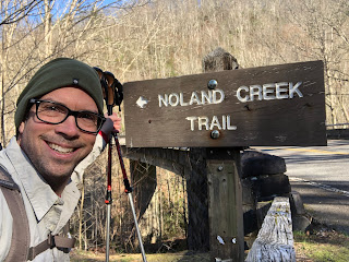
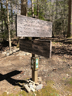
Noland Creek trailhead is on the Road to Nowhere, west of Bryson City, NC, with a parking lot for maybe 10 cars. The trail (and the creek) actually runs under the road, so you have to descend from the parking lot down a steep approach trail to get to Noland Creek trail.
 |
Noland Creek trail parking lot
|
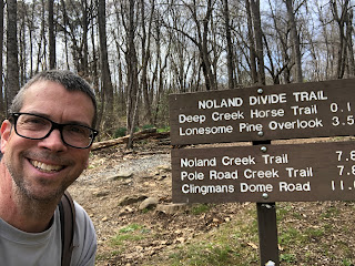
 |
| Actual Noland Creek trail selfie |
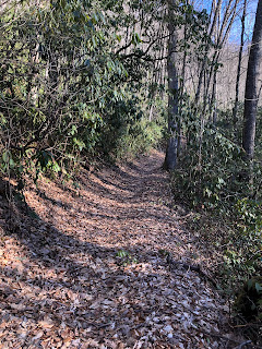
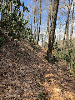
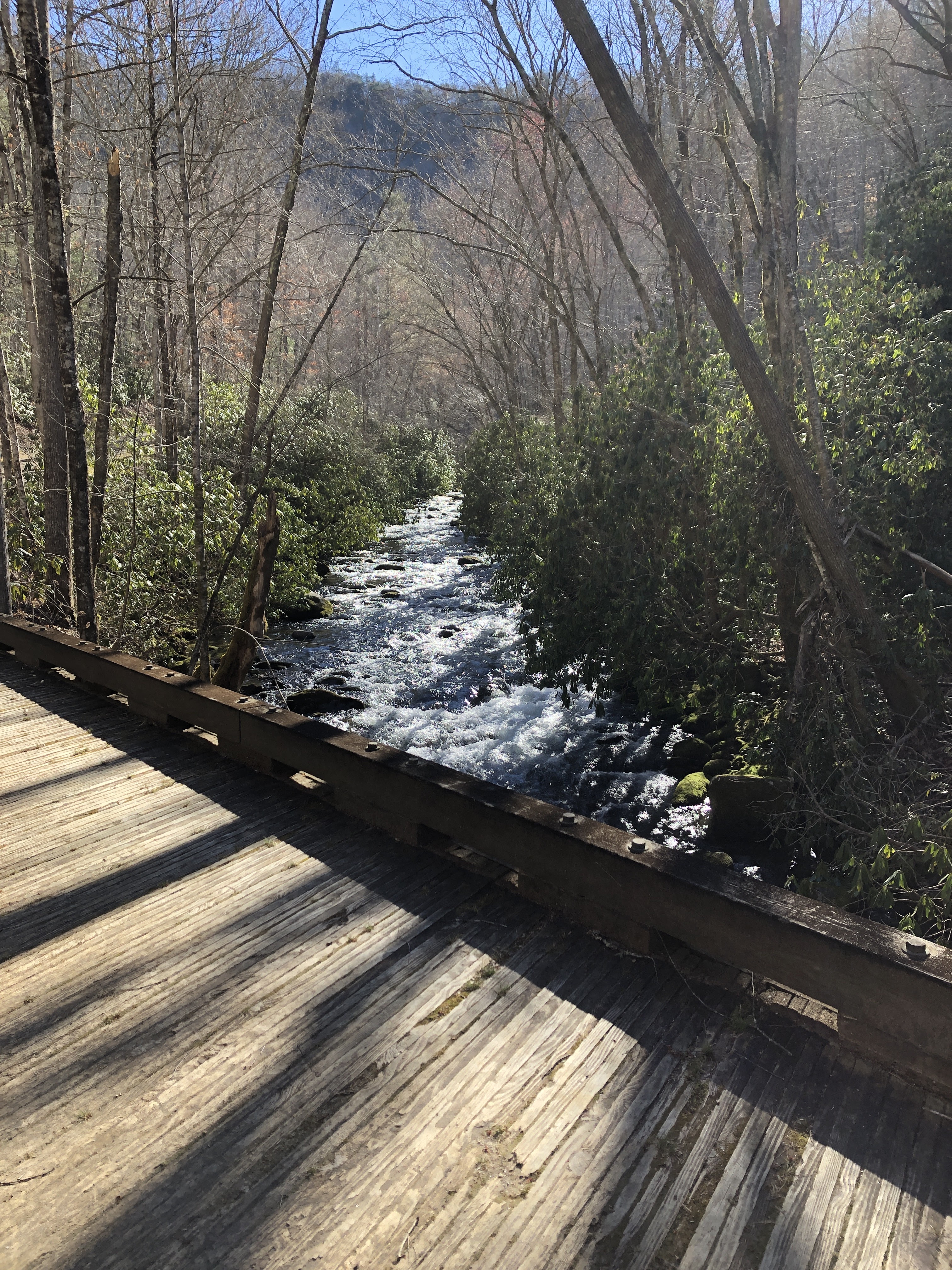
Noland Creek trail follows its namesake creek for most of its 10.3 miles, abandoning the creek valley only at the top of the trail as it approaches Upper Sassafras Gap at the junction with several other trails. Lower down the trail is an old roadbed - a gentle grade, wide and flat, with sturdy bridges crossing the creek. Makes for very easy walking.
 |
| View of Noland Creek from the first bridge |
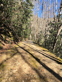 |
| Noland Creek trail - a wide old roadbed |
There are several backcountry campsites along Noland Creek trail, spaced out along the trail. The first one you pass is #65 (Bearpen Branch). The campsite is 0.1 miles off of the trail, so I didn't take the time and effort to investigate.
 |
| Marker for the side trail to backcountry campsite #65 - Bearpen Branch |
Noland Creek reminds of the many creeks that drain the south (NC) side of the main ridge: Hazel Creek, Eagle Creek, Forney Creek... Wide, rocky, cold and beautiful! There is something really magical about the sound of a mountain creek.
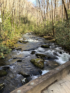 |
| Noland Creek from a bridge |
Like the other creek valleys, Noland Creek valley was also extensively settled pre-park. There are several spots with remnants of old homesteads. Large patches of daffodils were in flower as I passed through - a clear sign of settlement since they are not native plants. Yucca and Boxwood were also evident at several old homesites. I took my time as a meandered up the trail to stop at many of these sites and try to imagine the lives of the folks who lived here.
 |
| Stone steps leading up to an old home foundation |
 |
| Old home foundation |
A side trail leads UP to an old cemetery. The settlers in the Smokies always put their cemeteries high up, often on the top of ridges. This small cemetery had about 8 or 10 graves, including a couple of infants and one marker for someone "KNOWN BUT TO GOD". It was a beautiful site for a cemetery - the top of a narrow ridge, and with great views now in the early spring when the leaves are still off the trees.
 |
| Ridge-top cemetery |
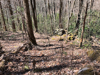
Along the path up to the cemetery is an old homesite, complete with a chimney that is still standing (cement held the rocks together, which I'm sure helps it stay standing). Scattered around this site are a lot of home artifacts - bedsprings, metal buckets, a broken ceramic sink... A beautiful spot for a home on a ridge just above Noland Creek.
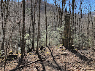 |
| Old home site with still-standing chimney |
 |
| Noland Creek trail - easy walking with bridges and a wide footbed |
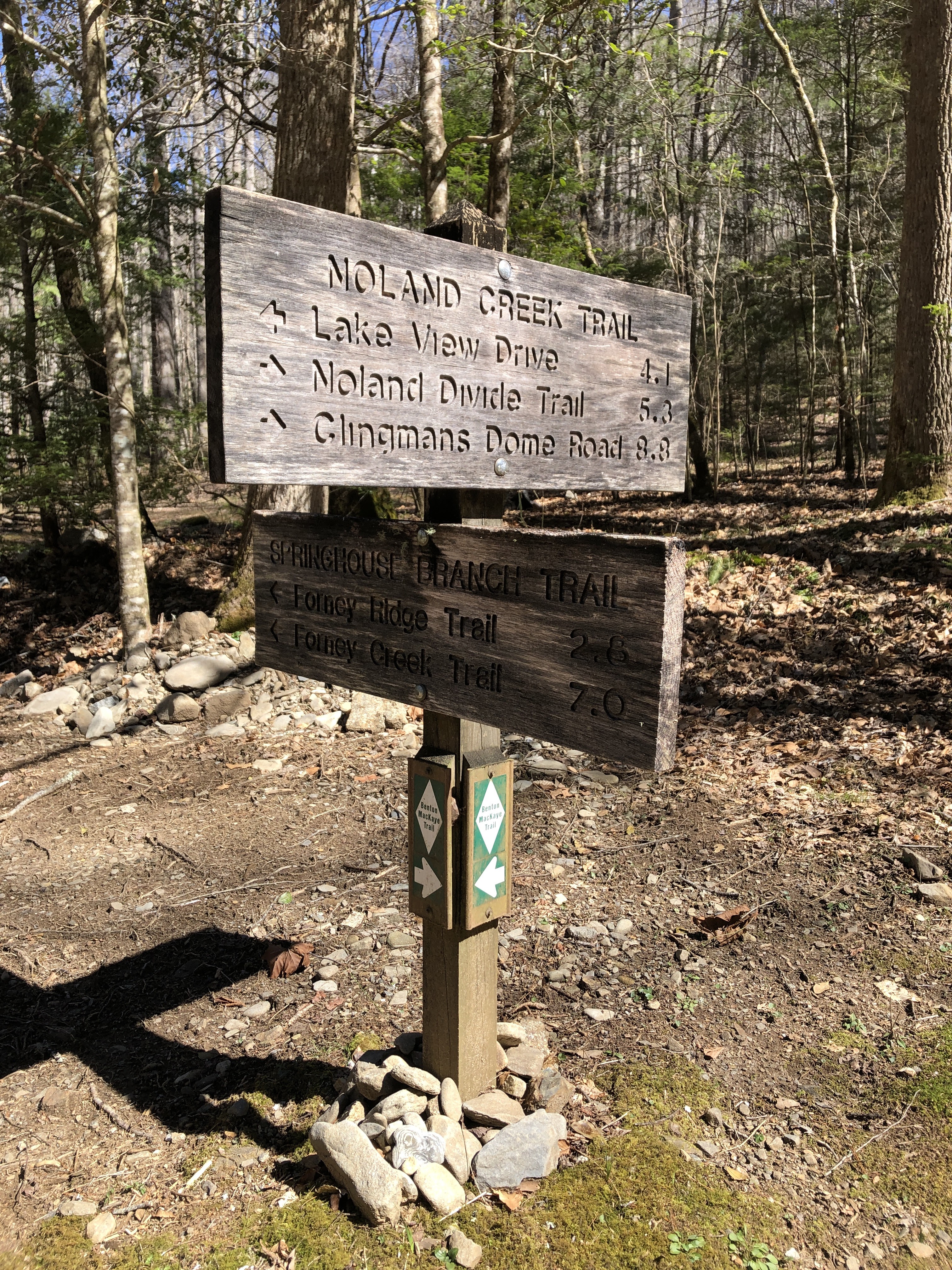
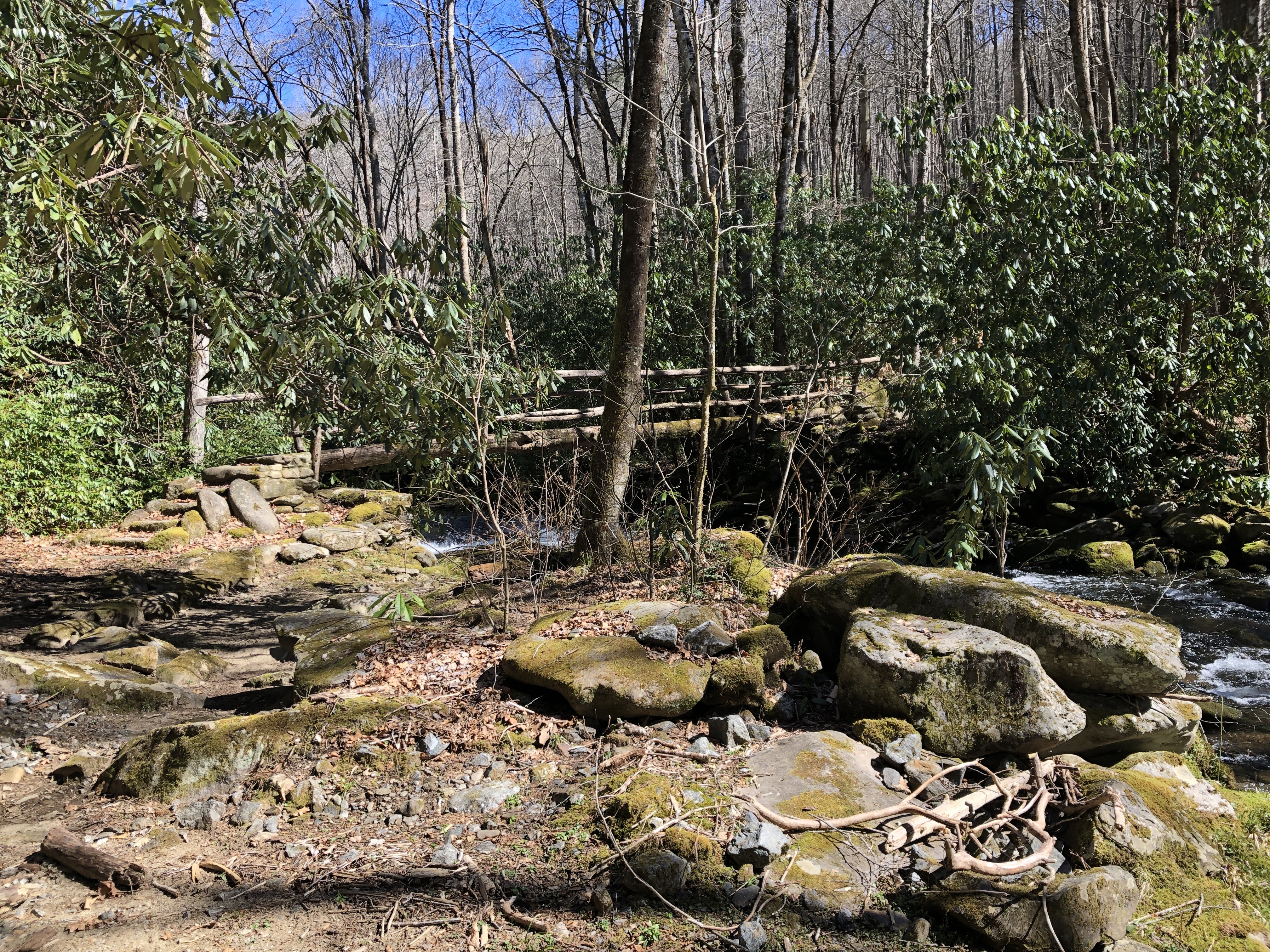
About 4.1 miles from the trailhead you reach backcountry campsite #64 (Mill Creek) and the junction with Springhouse Branch trail.
 |
| Noland Creek - Springhouse Branch trail junction at campsite #64 |
Campsite #64 is HUGE - several picnic tables, fire rings and tent sites are available. It's wide open, and is also a horse camp so there is a horse rack at one edge. Looks like a really nice place to spend the night. I stopped here for lunch, then hung up my pack on the cable system so I could make the up-and-back hike on Springhouse Branch trail without carrying my whole pack.
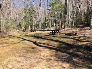 |
| Backcountry campsite #64 - Mill Creek |
I had done the western end of Springhouse Branch trail on a previous trip, but needed to complete the section between Board Camp Gap and Noland Creek trail. This is a 2.8 mile section that gains about 1300' of elevation along the way.
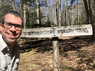 |
| Springhouse Branch trailhead selfie |
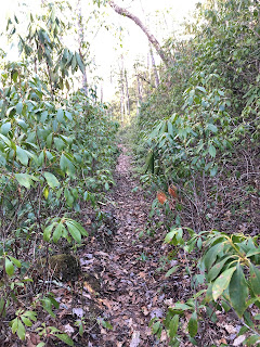
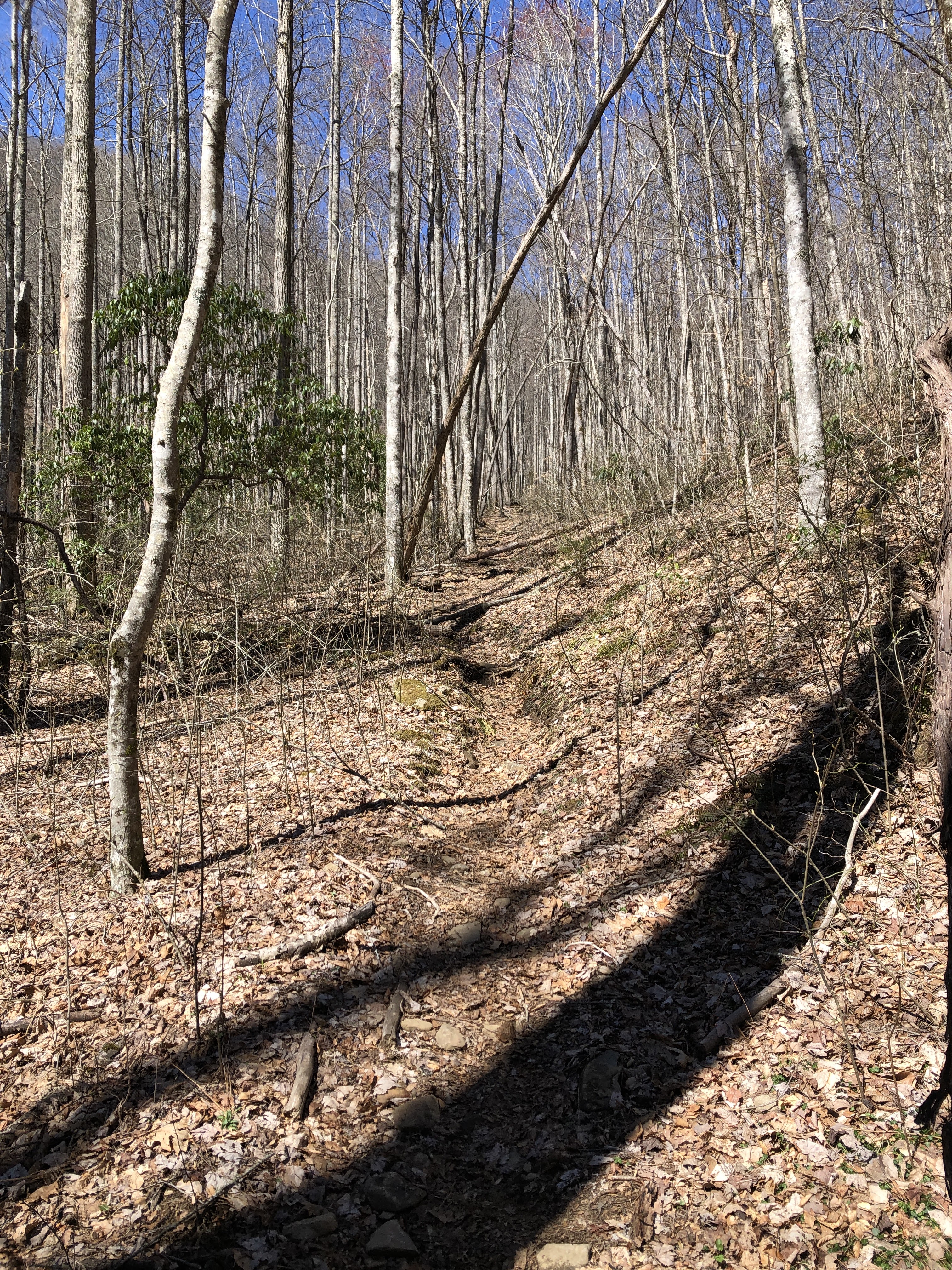
Unlike the Noland Creek trail, this section of Springhouse Branch trail is typical narrow, single-track Smokies trail. It follows Springhouse Branch creek for the 1st half, but is usually up the ridge a bit from the creek so you don't get a lot of creek views. The lower section is also flanked by lots of Dog Hobble bushes, so it's kind of like wading through foliage.
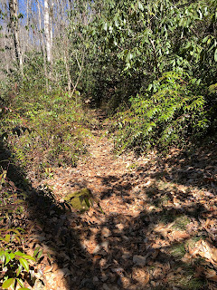 |
| Springhouse Branch trail |
 |
| More signs of habitation - rock piles of old chimneys and foundations |
 |
| Footbridge across the creek |
About 1/2 way up the trail crosses the creek and then starts to climb away from the creek and up the side of Forney Ridge on its way to Board Camp Gap. The trail climbs through open forest, and then ultimately along the side of a steep ridge as you get close to the top. After a long climb, it nicely flattens out for the last little bit. I met a group of spring break hikers from Wyoming here, and followed them all the way to the Gap.
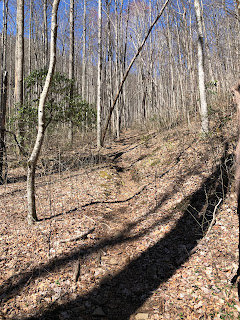 |
| Upper section of Springhouse Branch trail as it climbs up the side of the ridge |
I stopped at Board Camp Gap for a quick water break and to remember the last time I had been here. I always enjoy those connections to prior trips.
 |
| Trail junction at Board Camp Gap: Springhouse Branch and Forney Ridge trails |
 |
| View from Board Camp Gap |
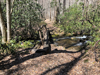
From here I turned around and retraced my steps back to campsite #64. I was glad to be headed downhill this time and made the 2.8 mile return trip in just about 1 hour. Back at the campsite I got my pack back on and headed up Noland Creek trail for another 1.4 miles to my campsite.
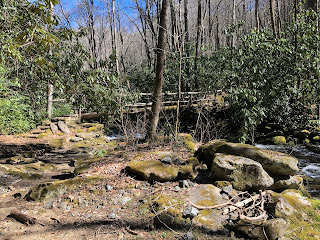 |
| Log footbridge over Noland Creek |
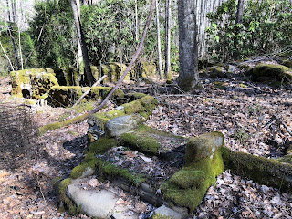
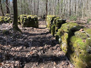
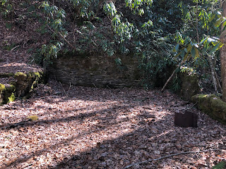 |
| Rock wall from an old building |
I rolled in to campsite #63 (Jerry Flats) in the late afternoon and did camp chores. Set up my tent & got out the sleeping stuff, filtered water, gathered some firewood (it was supposed to a cold night - lows in the 20s), and made dinner (Mountain House Lasagna).
The campsite is large & open with tent sites and bear cables on either side of the trail. I chose the east side, right by the creek. It's very pleasant and I had it all to myself. After dinner I enjoyed the campfire and the sounds of the creek. I managed to stay up until about 9 pm when the cold finally drove me to my sleeping bag. I took my zero-degree bag on this trip to be sure I would be comfy, and I was. Slept warm and well.
 |
| Campsite #63 trail marker |
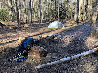 |
| My tent in the background and the fire-ring in the foreground. |
Day 2:
I crawled out of bed around 7:30 am to a very chilly morning! Got breakfast (oatmeal & coffee) and packed up pretty quickly. I could see the sunlight over the top of the ridge, but the campsite is in the creek valley so it wasn't until I had already started hiking an hour later that the sunshine finally hit the valley floor. The route for this day was to finish going up Noland Creek trail to Upper Sassafras Gap, and then down Noland Divide trail to the Deep Creek picnic area.
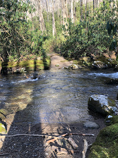
Above campsite 63 the trail crosses Noland Creek on a footlog, and turns to a more typical Smokies trail, instead of the road-like trail of the lower section. Shortly after the crossing on the footlog is an unbridged crossing. The NatGeo map has a "high water caution" note for this crossing, suggesting that is can be potentially dangerous when the water is high. I put on my water shoes and rolled up my pants legs and made it across with no problem - it was probably mid-thigh high on me at its deepest point. It WAS painfully cold - my legs got numb and tingly almost immediately! But made it safely across with no issues.
 |
| Noland Creek trail |
 |
| Unbridged crossing of Noland Creek |
 |
| Wading through a green tunnel of Rhododendron, Mountain Laurel & Dog Hobble |
Like many of the creek valley trails on this side of the Smokies, the last little bit climbs steeply. The trail passes backcountry campsite #61 (where I met some spring break hikers from Texas), and then turns away from the creek and up the side of the ridge.
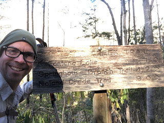
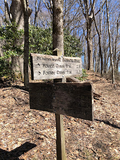
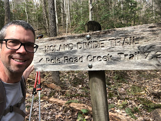
Upper Sassafras Gap is the meeting point of Noland Creek, Noland Divide, and Pole Road Creek trails. I had done the upper section of Noland Divide and Pole Road Creek trails on a previous trip, so now it was time to turn south and finish off the Noland Divide trail. I stopped and rested here for a bit and looked at the map to discern any waypoints to look forward to. Unlike climbing up Noland Creek where there were lots of campsites and homesites to look forward to and to mark progress, the Noland Divide trail is marked mostly by the knobs it passes.
 |
| Trail junction at Upper Sassafras Gap |
 |
Trail junction at Upper Sassafras Gap
|
 |
| View from Upper Sassafras Gap |
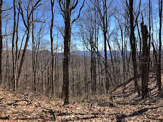
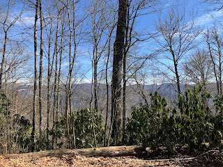
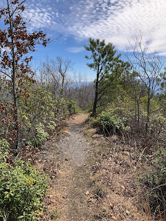
The first 3 miles of Noland Divide trail south of the Gap sort of roller-coaster up and down. It is mostly ridge-top / ridge-side hiking with some nice views across the valley to the other ridge (now - when the leaves are not yet out on the trees at least). The trail skirts the edge of many of the knobs (Sassafras Knob, Coburn Knob) as it winds its way south.
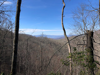 |
| View from Noland Divide trail |
 |
| Noland Divide trail |
About 4 1/2 miles south of Upper Sassafras Gap the trail reaches the Lonesome Pine Overlook. I didn't know what to expect from this overlook, but it was super cool! It's an exposed outcrop of slate (reminds me a bit of Cliff Tops at Mt. LeConte or Chimney Tops, but on a much smaller scale) that provides a great lookout over Bryson City. While I was there I had it all to myself and stopped for lunch in the sunshine.
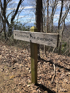 |
| Lonesome Pine Overlook marker |
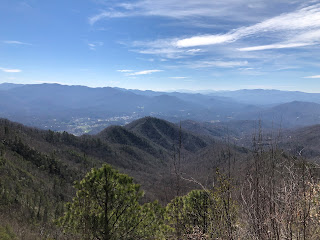 |
| View of Bryson City from Lonesome Pine Overlook |
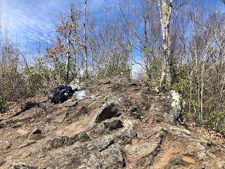 |
| The Lonesome Pine Overlook rock outcrop |
From Lonesome Pine Overlook the trail follows the knife-edge of Beaureguard Ridge which is dry and piney and has lots of rock outcroppings. Very cool hiking. From here on down I encountered LOTS of day-hikers headed up to the overlook. Apparently it is a very popular day-hike destination!
 |
| The knife-edge trail along Beaureguard Ridge |
Ultimately the trail drops off of Beaureguard Ridge and starts descending the ridge-side down toward Deep Creek. The trail is well-constructed and mostly smooth, although it is narrow. It was mostly easy walking from here.
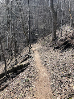 |
| Noland Divide trail descending the ridge-side toward Deep Creek |
 |
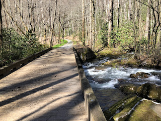
| Back at Deep Creek |
 |
| Deep Creek trailhead |
I strolled into the Deep Creek picnic area about 3 pm and back to my car. Lots of folks out picnicking on a beautiful Thursday afternoon. I changed into some clothes I had waiting for me in the car, and then headed out for the 2-hour drive back home.
Really nice weather over the trip - daytime temps in the 50s/60s with lots of sunshine. Cool campsite, lots of history, neat overlooks and views. All in all a very nice trip. Happy to have these trails completed, and looking forward to my next trip - probably finishing off the section of Lakeshore trail that I have yet to complete from Hazel Creek over to the Road to Nowhere.
Hope you all get out and enjoy the spring weather. I'm looking forward to the Spring Wildflower Pilgrimage in April, and some warmer weather hikes.
Til next time, happy hiking!


No comments:
Post a Comment