Monday, January 20, 2014

Rabbit Creek & Hannah Mountain (partial) trails

New Miles Completed: 7.0
Total Miles Hiked: 14.0
20 January 2014

Started with wet feet, and ended with wet feet…  Everything in between was glorious!

Rabbit Creek trailhead

The Rabbit Creek trail goes between Abrams Creek Ranger Station and Cades Cove.  Hannah Mountain trail goes from Parson Branch road up to Abrams Creek.  Today I did pieces of each, but didn't finish up either of them.

I started early this morning in Cades Cove where the Rabbit Creek trail shares a trailhead with the Abrams Falls trail.  The parking lot was nearly empty when I arrived.  One of the fun things about the Rabbit Creek trail is that it starts off going through Mill Creek.  Not over or around, but through…
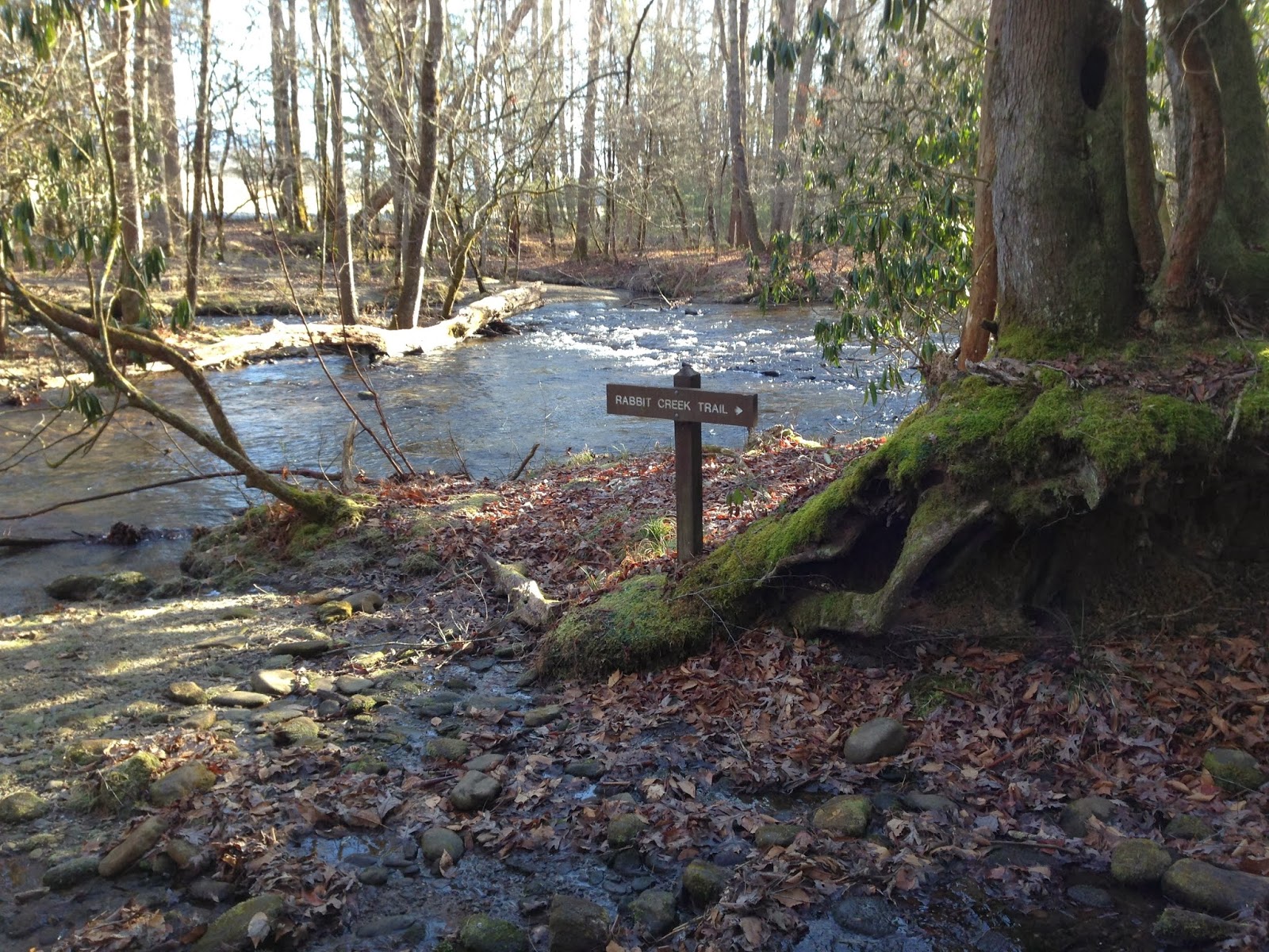
crossing of Mill Creek at the beginning of the Rabbit Creek trail

I knew this ahead of time, and was prepared to take off my boots and wade, but then I spied a fallen tree that spanned most of the creek.  With my trekking poles in hand I headed across the fallen tree, hopeful that I'd avoid cold, wet feet.  Sadly, the creek got deeper and my trekking poles didn't reach the bottom. The fallen log got slippery, and kerplunk - I ended up knee-deep in Mill Creek.  I climbed out with nothing hurt, but it was not an auspicious beginning to the day.

Turns out it really didn't matter.  My feet would have gotten wet anyway, as a lot of the Rabbit Creek trail leading up out of Cades Cove is more creek than trail.  Rabbit Creek trail climbs quickly out of Cades Cove to a series of ridges, starting with "Coon Butt" :-)  The trail traverses gently up and down these ridges for a while before ultimately dropping down, down, down toward Rabbit Creek.

the Rabbit Creek trail on the dry, piney Cades Cove side

As the trail drops down into the Rabbit Creek valley it passes Campsite #15.  This is a really nice, open campsite, just up the hill from Rabbit Creek.  It looks to have several reasonable tent sites and a nice campfire area.  Water is easily accessible from Rabbit Creek.

marker for campsite #15

Campsite #15 - campfire area

Directly downhill from the campsite is Rabbit Creek which must be forded / rock-hopped.  By this time my feet were sort of dry-ish after their run-in with Mill Creek and the water laden ascent up the ridges. So I wasn't anxious to get them soaking wet again.  There are a series of well-placed rocks across Rabbit Creek at the ford so one can MOSTLY get across dry.

ford at Rabbit Creek

From here the trail ascends again for about a mile up to Scott Gap where the Rabbit Creek and Hannah Mountain trail intersect.  The Rabbit Creek trail continues on from Scott Gap toward Abrams Creek ranger station, but I turned north on the Hannah Mountain trail towards Abrams Creek.  It's about 1.9 miles from Scott Gap to the junction with Abrams Creek.
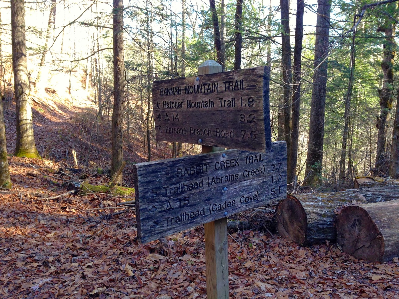
Rabbit Creek - Hannah Mountain trail junction

Also a few hundred yards below Scott Gap is Campsite #16. I walked down to the campsite, but I didn't see a whole lot to recommend.  It seems to be on a fairly sloped area and I did not see an obvious water source.

marker for campsite #16

campsite #16

Hannah Mountain trail from Scott Gap north is a pleasant walk through tulip poplar, hemlock and rhododendron.  There are a LOT of downed trees along this section, presumably from the tornado that blew through the area in 2011.  The trail descends gently for the first mile or so, and then begins to really drop on its way down to Abrams Creek.

pretty little waterfall along the Hannah Mountain trail


the final descent to Abrams Creek

I remember seeing this spot from the other side of Abrams Creek about four years ago.  We had camped at Campsite #17 and then hiked up to Abrams Falls, and I remember stopping at the spot where the southernmost section of the Hatcher Mountain trail meets Abrams Creek.  It was cool to see it from the other side of the creek today.

looking across Abrams Creek to Hatcher Mountain trail

I stopped here to soak in some sun, eat lunch and dry out my socks a little.  As I sat I *briefly* contemplated attempting to ford Abrams Creek so I could take the Abrams Falls trail back to Cades Cove.  It would have cut off about 3 miles of walking and would have made a nice loop, but the water was cold and deep in places, and I was alone.  Plus that was NOT the itinerary I had left behind, so if I got into trouble nobody would know where to look for me.  Someday I want to come back and make this ford, but probably in August or September, and certainly not alone.

From here I turned around and retraced my steps.  When I finally arrived back at the trailhead I didn't try the downed tree again.  I simply plunged straight through the creek at the ford.  The water was COLD, but it was quick.  

All in all it was an amazing day to be out in the Smokies.  The sky was blue, the temperature was cool, but sunny, and I really enjoyed hanging out on the banks of Abrams Creek.  Can't believe this is the first time I've checked off any new miles in the park since last June!  Still, I'm making slow and steady progress on completing all the trails in the park.  Looking forward to getting out there again.

Til next time, happy hiking!

Monday, June 10, 2013

Appalachian Trail: Newfound Gap to Davenport Gap

New Miles Completed: 31.4
Total Miles Hiked:  ~ 35
7-9 June 2013

Thirteen years ago I hiked the western portion of the Appalachian Trail through the Smokies, from Newfound Gap down to Fontana Dam.  It was the first big backpacking trip I did after we moved to Tennessee and I did it solo.  I was relatively ill-prepared and inexperienced then, and I'm sure I carried WAY too much in my pack, but it was a great trip nonetheless.  This past weekend I finally got to finish off the AT in the Smokies by doing the eastern section: from Newfound Gap to Davenport Gap.  This time I went with my hiking buddy Shane, and I was a lot better prepared and more experienced.  It was a fantastic trip!


trailhead at Newfound Gap

Shane's wife Sarah was kind enough to get up early and shuttle us up to Newfound Gap Friday morning.  It was drizzly, and the top of the mountains were socked in with fog.  I love the trail sign at Newfound Gap: "Katahdin Maine 1972.0"  I can imagine that's a little overwhelming to the AT thru-hikers who make it to this point.

In general the AT through the GSMNP follows the TN/NC border and the spine of the tallest mountains in the park.  Our starting point at Newfound Gap is over 5,000 ft in elevation and the bulk of the trail meanders up and down between 5,000 - 6,400 feet.

Day 1:  Newfound Gap to Pecks Corner shelter.  10.8 miles

The first day out we went nearly 11 miles.  Along the way we went up and over three peaks and passed both the Icewater Spring shelter and Charlies Bunion.

Icewater Spring shelter
 Icewater Spring shelter is only a couple of miles from Newfound Gap and sits on a fairly exposed ridge with outstanding views, so it's a very popular destination.  Sadly, when we arrived the mountain was still completely fogged in, so there were no views.  We did meet several hikers here, including a couple of long-distance hikers that we would see often over the next couple of days.  "Mush Mouth" and "Void" were friends from Kansas who are hiking from Springer Mountain, GA (the southern terminus of the AT) to Harpers Ferry, WV (sort of the midpoint of the AT).  We stopped in for a snack and to say hello.


Sand Myrtle in flower at Charlies Bunion
Charlies Bunion
The next major stop was Charlies Bunion, less than a mile down the trail from Icewater Spring.  This is a huge bare outcrop of slate with sheer drops on three sides, and (on clear days) amazing views down the valley.  It's a fun (but scary) place to visit and there are signs that warn parents to "closely control children."  The rock faces here were covered with Sand Myrtle in flower - this is a member of the Heath family that only grows on particular rock formations at high elevation in the Smokies.

I should point out that there are MANY trails that intersect the AT along its length in the GSMNP.  For the sake of brevity I will not mention or post pictures of all of the trail junctions like I usually do, but there are lots of ways to get up to the AT from the lower regions of the park.

Early in the afternoon I mentioned that I was getting hungry and that we should look for a place to stop for lunch.  Shane agreed, and not 2 minutes later we came around a corner of the trail to find a long block of rock at the edge of the trail with amazing views down into North Carolina.  The sun had come out and we basked as we ate and drank in the views.


view from the AT down into North Carolina
Our destination for the first night was Pecks Corner shelter which sits about 0.4 miles down the Hughes Ridge trail from the AT.


Pecks Corner shelter
Pecks Corner shelter is of the same general construction as all of the trail shelters in the park.  They are 3-sided stone structures with a two-level wooden bunk system, bench & table sets along the front for cooking, a fireplace, and cables to hang food bags away from the bears.  This particular shelter sits pretty far down a narrow valley.  There was an excellent spring and a composting privy on site.  In addition to Mush Mouth and Void we met up here with several other folks.  A mom and her two kids from San Diego, CA who are working on a thru-hike of sorts; Cobweb, a southbound thru-hiker who is finishing up his interrupted thru-hike from last year; and a section hiker from west Tennessee who teaches school in southern Illinois.  All in all it was a diverse and interesting group and we had lots of good conversation.  As is usual on the trail though, bed time comes early and we were all in our sleeping bags by about 8 pm.

Day 2: Pecks Corner shelter to Cosby Knob shelter. 13.3 miles


up and ready to hit the trail the morning of day 2 at Pecks Corner shelter
Our second day out the trail went up over (or around) the summit of some very high mountains: Mt. Sequoyah, Mt. Chapman, and Mt. Guyot, all over 6,000 feet in elevation.  From there the trail drops down toward Cosby Knob and Low Gap.  This section of the trail is one of the most remote in the park - you are many miles away from any road here.  It's also amazingly beautiful as you traverse the narrow spine of the mountains.  In many places the trail is not more than a few feet wide with sheer drops of hundreds or thousands of feet down on either side.  It's both eerie and exhilarating at the same time.  And the views...  Pictures simply can't do justice to the beauty.


early morning mist rising from a mountain valley
Along the way we stopped at the Tricorner Knob shelter for lunch.  This shelter is very close to the AT and sits in a nice open and sunny area.  The spring that is the shelter's water source is right next to the shelter and spreads out to form a very wet and muddy area directly in front of the shelter. 


Tricorner Knob shelter
After lunch and a rest we headed on down the trail.  Along the way we passed (and almost missed!) the wreckage of an Air Force F-4 jet plane that crashed here on January 4, 1984.  There's a good description and lots of pictures here.


piece of twisted metal from the plane wreck
We also met up at the Snake Den Ridge trail junction with a group of trail volunteers who were heading up the trail to do maintenance.  They were part of the S.W.E.A.T. Crew program and carried not only all the necessary camping equipment and food, but also all the tools and materials necessary for a week's worth of trail work.  Thanks a lot for everything you do!


rake and axe handles from the S.W.E.A.T. crew leaning against the trail sign

Late afternoon we made it in to the Cosby Knob shelter for the night.  Shane and I had stayed here with some of our Boy Scouts back in February when there was quite a bit of snow and temperatures in the single digits. 

Cosby Knob shelter
We met up again with some folks from the previous night, and also met some new ones, including a couple more thru-hikers.  Fun conversations again, and in bed around 9 pm.  There were a couple of really heavy-duty snorers though, that made sleeping tough.  It was definitely NOT the most restful night I've ever had on the trail, for sure, but I guess that's one of the prices of staying in a shelter.

Day 3:  Cosby Knob shelter to Davenport Gap and I-40.  11.2 miles

Sunday morning we actually covered 0.8 miles of trail that we had hiked back in February, from Cosby Knob shelter down to Low Gap.  And from Low Gap, back up fairly steeply to the ridge of Mt. Cammerer.  One of the things I was really looking forward to on this trip was a visit to the Mt. Cammerer fire lookout.  I'd seen pictures, but never had the chance to visit before.  It was a beautiful structure, on a beautiful site, with beautiful views!  Absolutely amazing!

Mt. Cammerer fire lookout
me at the Mt. Cammerer lookout
view from Mt. Cammerer lookout
The side trail from the AT out to the lookout is 0.6 miles each way, with its own ups and downs and rock scrambles.  But it was well worth the extra 1.2 miles!

From the top of Mt. Cammerer the AT drops rapidly from nearly 5,000 feet elevation down to about 2,000 feet at Davenport Gap over a distance of about 5 miles.  It was like dropping through time as well - plants that were still in bud up top were out in full flower the further down we got, and we started to see species that occur at lower elevations that we hadn't seen up high.  The temperature and humidity also seemed to increase steadily as we descended.

About a mile from Davenport Gap and the park boundary is a short side trail to the Davenport Gap shelter.  

Davenport Gap shelter
It sits in a picturesque little hollow, but was somehow a bit stifling.  It's one of the few (maybe the only?) trail shelters that still has a wire fence across the front to keep out the bears, and does not have bear cables to hang food bags from.  There's also no privy.  Not exactly sure why, but it just didn't strike me as someplace I'd like to spend an evening.  We stopped to eat a bite of lunch and fill our empty water bottles before heading out.  From here it was just a hop, skip and jump down to the park boundary at Davenport Gap.

Shane at the park boundary in Davenport Gap
While this finished up the AT through the GSMNP for us, we still had 1.9 miles of hiking on the AT to get to Interstate 40 and our pickup point.  From Davenport Gap the AT first winds through a dry piney forest, and then drops down into a cool hardwood & rhododendron forest with a lovely creek paralleling the trail.  The creek ultimately spills  into the Pigeon River and the AT crosses a bridge over the river and then under the I-40 overpass.  My son Jesse arrived to pick us up just about 5 minutes after we stepped out of the woods - perfect timing (especially good since my cell phone reception was pretty spotty around there).

AT marker at the trail entrance near I-40
What else can I say?  This was a trip that I've planned and dreamed about occasionally since 2000, and actively for about the last five years.  Shane is the best hiking partner I can imagine - we're well-suited to each other in a lot of ways, and always have a great time hiking and backpacking together.  The trail was tough - in places it is narrow and deeply rutted, it's often very rocky, and this weekend was very wet (my boots didn't fully dry the whole time we were out).  But the beauty of the views, the excitement of walking the narrow ridges, the gorgeous wildflowers, and cool side trips all combined to make this one of the best backpacking trips ever.  I highly, highly recommend this trip to anyone who is prepared for the rigors and interested in the scenery.

I plan for this to NOT be my last backpacking trip this summer.  Definitely want to get a few more trails knocked out, so stay tuned for more.  

Til next time, happy hiking!

Friday, May 31, 2013

Road Prong Trail

New Miles Completed: 2.4
Total Miles Hiked: 4.8
30 May 2013

The Road Prong trail is part of an old over-mountain road used by the Cherokee and early settlers to get back and forth between the NC and TN sides of the mountains.  In its current form it connects Clingmans Dome road with the Chimney Tops trail.  It drops about 1500 feet in elevation over its 2.4 miles, and follows the Road Prong creek the whole way.


trailhead at Indian Gap

William Britten has a nice blurb and some photos of Indian Gap here.  From the parking area the trail immediately begins to descend through the Spruce-Fir forest.  The trail is VERY rocky, and the footing can be treacherous if you're not careful.  The descent is often steep, and combined with the rocks it made for some slow going downhill.

While it's summer down in the valleys, the wildflowers at this elevation still think it's spring.  A number of wildflowers were out in full bloom, and in particular the bluets were EVERYWHERE along the creek.

Bluets

Bluebead Lily

Umbrella Leaf

Speaking of the creek, the trail follows the Road Prong creek and there is a section in the middle where the creek becomes the trail...   There are numerous creek crossings where you're rock-hopping (or wading).  It was really quite beautiful and a lot of fun!  But the water wasn't high and the rocks are numerous so the crossings weren't a problem.

one of the MANY creek crossings via rock-hopping

Below the section of creek crossings the terrain gets steeper, and there are a bunch of absolutely gorgeous waterfalls.  I would highly recommend a visit to this trail just to see the waterfalls!  Most of them require some off-trail work and rock scrambling to get to, but they're well worth it.


After this section the Road Prong creek veers off to the right (east) while the trail continues down (north) to meet up with the Chimney Tops trail.

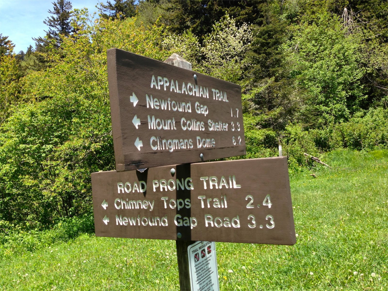
Road Prong trail - Chimney Tops trail junction

We had actually intended to hike up to the Chimney Tops, but it took us a lot longer to get down than I expected, so we had to turn around here.  Because of the steepness and rockiness of the trail it took us nearly 2 hours to make the 2.4 mile descent.  Granted, this included a lot of side trips to see waterfalls or climb on the trail-side rocks, but it's not a quick descent any way you do it.

The return trip was quicker (about 1.5 hours) and while very steep, it was actually probably easier going up than down.  Along the way back up we encountered some critters including a beautiful little garter snake and a bright red crawdad.


The garter snake we probably wouldn't have even noticed if Duncan hadn't nearly sat on him, but the crawdad was hard to miss!  And he was mad that we were paying any attention to him at all.

There's lots to recommend about this trail:  good history (there's a marker at Indian Gap with historical notes), nice wildflowers, a challenging but beautiful trail, fun creek crossings/rock hopping, lots of nice waterfalls.  It's steepness & rockiness shouldn't be underestimated - it's not an easy trail.  But it's definitely worth the effort.

Til next time, happy hiking!

Monday, April 22, 2013

Brushy Mountain Trail

New Miles Completed: 4.5
Total Miles Hiked: 11.8
21 April 2013

Spring has finally sprung here in the Smokies!  It's a glorious time of the year for hiking and I took full advantage yesterday.  I had been to Brushy Mountain twice before, but both times had come up the Trillium Gap trail which comes up from Roaring Fork Motor Nature Trail.  Brushy Mountain trail starts in Porters Flats, out at the end of the Greenbrier Road, a mile along the Porters Creek trail.

Porters Creek trailhead

Porters Creek trail is widely known as a great spot for wildflowers and it definitely didn't disappoint!  Rather than post a zillion wildflower pictures here I'll give you a link to my Facebook photo album where you can see them all.

The first mile of the Porters Creek trail is a continuation of the gravel Greenbrier Road, although vehicles are no longer allowed.  Along the way you will see lots of evidence of the former occupants - rock walls and stairs, and even the old Ownby Cemetery.

rock wall built by pre-park residents

the Ownby Cemetery

At the end of the gravel road is a loop turn-around - this is where the Brushy Mountain trail begins, and also where a short side trail leads to the John Messer cantilever barn (1875) and the Smoky Mountain Hiking Club Cabin (1934).

John Messer cantilever barn

Smoky Mountain Hiking Club Cabin

From here the Brushy Mountain trail heads 4.5 miles up to Trillium Gap before rising another 0.4 miles up to the summit of Brushy Mountain.  The total elevation gain from the Porters Creek trailhead to the summit is about 2900 feet over a total distance of 5.9 miles.  It's not terrible in terms of steepness, but it is pretty persistent.  You are going UP almost the whole way.  Much of the trail looks like this - fairly deeply rutted and constantly uphill.

typical section of Brushy Mountain trail

Once you leave Porters Flats and start heading up hill the trail follows a typical pattern of ridge-side walking and then coming back into a draw with a creek crossing.  The ridge-sides tend to be drier and have relatively few wildflowers, while the moist, cool draws have a profusion.  There are some nice views back toward Greenbrier Pinnacle too.

Greenbrier Pinnacle as seen from Brushy Mountain trail

Water slide at trail crossing of Trillium Branch

I made a rookie mistake on this hike - one I often warn my kids and Boy Scouts about.  I started thinking I was closer to the end than I really was, and started looking for the end of the trail around every corner.  As long as I've been doing this I should know better, and it's the most frustrating thing in the world!  As I was hiking along thinking I must almost be there, I came around a corner to this view:

Brushy Mountain ridge (w/ dead hemlocks in the foreground)

that's Brushy Mountain - I still had to wind my way around to Trillium Gap and then up to the top of that ridge before my day was half-done.  That was cause for a rest stop, a snack & drink, and a pep talk.  But at least now I knew where I was, and that's always a relief, even if it means you still have a long way to go.  

The rest of the trip up to Trillium Gap was quite pleasant.  The trail goes through some nice meadow-ish areas with lots of Trillium, Trout Lily and Spring Beauty.  It was about 4 pm by now and the sun was starting to get that awesome late afternoon slant that makes everything look even cooler than normal.

Trout Lily & Spring Beauty

I FINALLY ambled into Trillium Gap and heaved a big sigh of relief.  And I have to rant about this again - there are NO Trilliums in Trillium Gap...  There's a lot of grass (which is why it used to be called Grassy Gap), but no Trilliums.  It makes no sense!

trail junction sign in Trillium Gap

From here it's just another 0.4 miles up to the summit of Brushy Mountain along a very deeply rutted trail.  Brushy Mountain is cool because it's a heath bald - no tall trees, just lots of heath plants like Rhododendrons, Mountain Laurels, Sand Myrtles, etc.  So the views from the top are great!

view to the south from the summit of Brushy Mountain

I stayed up top for about a half hour soaking in the sun, snacking & drinking, and resting my feet.  It took me right at 3 hours to go the 5.9 miles up - not bad considering the elevation gain and lots of stops to take flower pictures.  It took about 2 hours to make the return trip down.

Brushy Mountain is always worth the trip, no matter which way you choose to come up.  The views from the top are awesome, and it's a unique habitat that makes the visit even more interesting.  The Brushy Mountain trail itself is nice.  It's in fairly good shape, and for the most part not terrible rocky or rooty (although there are some sections that are).  There were several down trees, but none that made the trail impassible.  The sections near Trillium Branch, and as you approach Trillium Gap are both good for wildflowers and quite pleasant.

So all in all it was a good day - hey, it was a spring day in the Smokies!  Of course it was a good day!  

Til next time, happy hiking!

Saturday, February 2, 2013

Low Gap Trail

Low Gap Trail
New Miles Completed: 2.9
Total Miles Hiked: ~10
1-2 February 2013

We had been trying to put together a Boy Scout backpacking trip for a month.  We had one scheduled for last weekend, but then an ice-storm hit and the park roads were all closed.  So we re-scheduled for this weekend, on trails up at Newfound Gap...  Then MORE snow was forecast for this weekend so we scrambled to make alternate plans.  That plan was going out from Cosby Campground on the Low Gap trail, up to the Appalachian Trail to stay at the Cosby Knob shelter, and because of snow and ice that's what we ended up doing.


Our scout crew

So normally one would just pick up the Low Gap trail right at the Cosby Campground.  Unless, of course, it's winter and the Cosby Campground is closed.  In that case you have to park 1.7 miles down the road and walk up to the campground to get to the trailhead.  And by the way, the backcountry office may forget to mention this minor detail when you make your reservation.

The Low Gap trail from Cosby up to Low Gap and the Appalachian Trail is fairly short, but also constantly uphill.  You gain about 2000 feet in elevation over the 2.9 miles so it's fairly relentless. Add in a layer of snow and it can be quite a challenging hike.

That said, it's also a beautiful hike.  The trail follows Cosby Creek much of the way as it leads up the mountain.  It's a forest of hemlock and rhododendron along the creek which rushes over numerous little waterfalls.  The sun was shining brightly and the snow just made everything even more magical.


Cosby Creek


View down the trail from one of the many stream crossings

Given the elevation gain and the snow we made fairly slow progress, so it was starting to approach sunset when we finally rolled into Low Gap and the junction with AT.

Low Gap:  junction with Appalachian Trail

At that point we were all pretty spent.  Luckily it was "only 0.8 miles" up to the shelter.  Unfortunately, it's about another 500 feet of elevation gain over that 0.8 miles.  We were quite happy to finally get to the Cosby Knob shelter and find some friendly faces and a fire already going.

trail sign for the Cosby Knob shelter

We stayed the night and slept in late - it was a COLD night.  After a leisurely breakfast we packed up and headed back down the way we had come.  

Our Boy Scout crew getting ready to head back down the trail.

For a couple of the scouts this was their first real backpacking trip.  Talk about trial by fire (or ice)!  The return trip was considerably quicker, and though the sun was shrouded by clouds the day was warmer.  We made it back home safe and sound in the late afternoon.  I was reminded just how much I love winter backpacking.  Hopefully this won't be the last winter trip this year.

Til next time, happy hiking!